Ertach Kernow - Visiting Land’s End
Land’s End hold some attraction for many people, perhaps in the name, the location or the rugged coastline. Recent news is that the owners were not renewing the contract for Courtwood Photographic a Penzance-based photo processing company who have held the contract and owned the famous signpost there for nearly 70 years. It looks as if the company who own Land’s End will be creating their own version of this well-known signpost and no doubt increasing the commercialisation of this iconic spot still further.
As always click the images for larger view
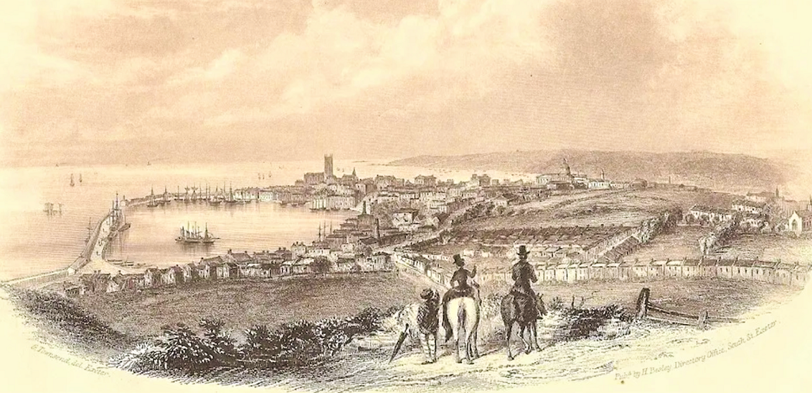
The commercialisation of Cornwall as a tourist destination really took off following the completion of the Royal Albert Bridge in 1859. With the joining of the Cornish rail network to that of England there was an increase in passenger traffic, and this included Penzance. The original railway station there was completed by the West Cornwall Railway as a terminus for the line from Redruth opening in March 1852. Rail travel from London right through to Penzance was now possible and that would also have an effect of increased visitor numbers to Land’s End.
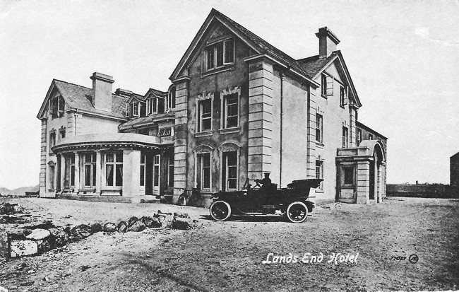
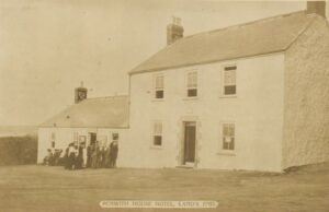
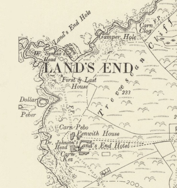
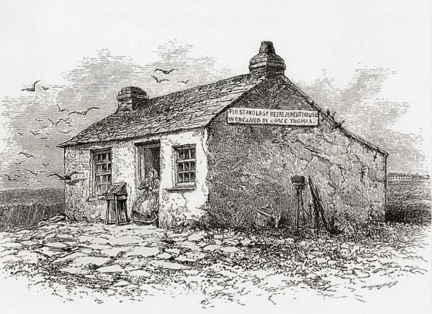
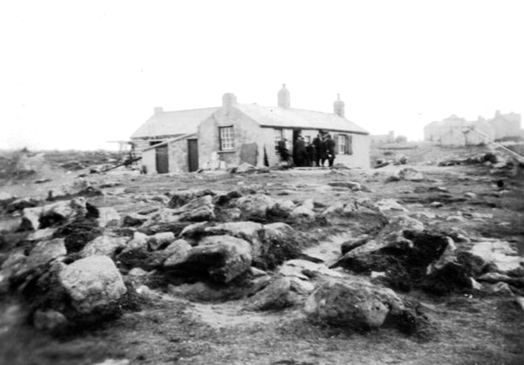
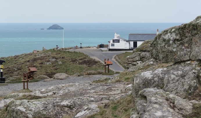
Commercialisation of Land’s End began on a small scale in the 19th century with the owners of the First and Last Inn at Sennen. Thomas and Margaret Toman were part of a widely extended family who owned much of the land around Sennen. The area comprising Land’s End was known as Trevescan Cliff, within the larger agricultural settlement of Trevescan. This land was held by another branch of this extended family and used as a turbary, where the cutting of peat took place. Shortly after the death of the owner Isaac Vingoe in 1853 the land was purchased by the Toman’s. By 1857 it was reported that certificates had been granted for the ‘First and Last Hotel’ beginning the first tourist accommodation actually at Land’s End. By 1881 Thomas was living at what was known as Land’s End House on Trevescan Cliffs and giving his occupation as a Hotelkeeper. Although Penwith House Temperance Hotel was said to have opened close by to the Tomen’s new hotel in 1860 this is not noted on the 1876 Ordnance Survey map. A little later the small ‘First and Last’ cottage which served tea and other refreshments very close to Land’s End itself was opened. From 1861 the Land’s End Hotel began to be extended with the other earlier buildings also added to during the 19th century. By the turn of the 20th century there was a busy tourist trade taking place, albeit interrupted by World War I.
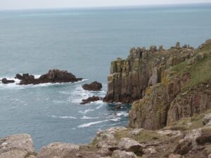
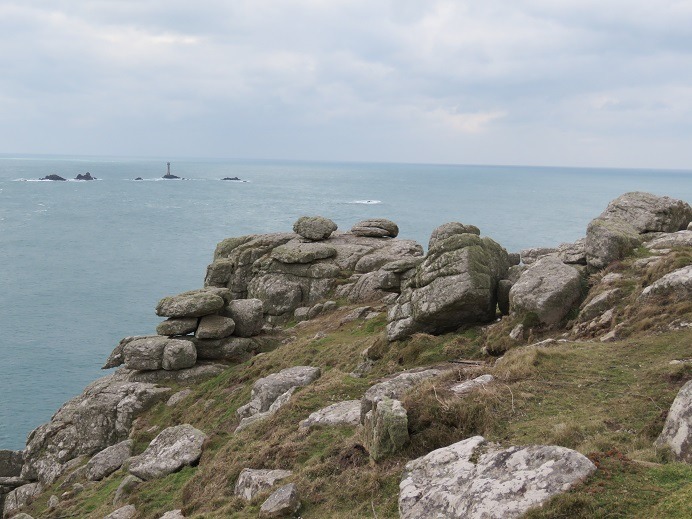
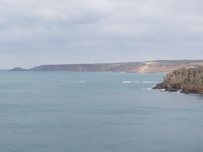
Even prior to the Toman’s starting their tourist business there were visitors who wrote about their visits to Land’s End. In the late 18th century William George Maton a physician with interests in natural history and antiquarian topics travelled through Cornwall and the western counties of England during 1794 to 1796. Of reaching Land’s End he wrote ‘After crossing some rocks, which we at first conceived to be the final barriers to our progress westward, we came to the grand promontory that projects into the Atlantic farther Land's End. than any other part of the Cornish coast. This is the Land's end a very striking spot both on account of the vastness of the objects it presents, and the convulsed features of the surrounding country. There is a cavern underneath, and here the waves of the ocean burst and bellow with a tremendous fury. The huge detached piles of rocks lying just off the land must have once adjoined to it, and we may imagine the latter to have been once connected with the distant isles of Scilly. Commenting on the geology Maton wrote ‘The rocks at the Land's-end, and in most parts of this district of Cornwall, consist of a very close species of granite, that takes a good polish and is applied to a variety of useful purposes.’ This was likely serpentine, which would in the 19th century become extremely popular for ornaments and other uses, especially from The Lizard district of Cornwall.
The renowned 19th century Cornish archaeological artist John Thomas Blight visited, and first published ‘A week at the Land’s End’ in 1861. This was republished in 1989 with an introduction by the late Professor Charles Thomas who was in his time one of Cornwall’s pre-eminent archaeologists and historians. Blight begins; ‘The region … presents us with scenes and memories which no other district of our land affords. There are the bold, magnificent cliffs, and ‘Towering headlands crown'd with mist,’ guardians of the western coast. There are hoary monuments of ages past—many of them well preserved from the destroying hands of time, yet surrounded by a deep halo of mystery, which the speculations of the antiquary can scarcely penetrate.’ He continues, ‘Where, again, in our native land, shall we find a tract of equal extent offering so many attractions in the marvellous variety and grandeur of its scenery, the deep interest of its historical associations, and the vast abundance of its ancient monuments? The remains of castles and fortifications which crown the summits of the most important hills and border the coast, standing on the very edges of the cliffs, are evidences of the fierce warfare once carried on: indeed, no portion of the whole country of the same area retains more numerous vestiges of the structures which our forefathers reared to protect themselves from their several foes.’
A small book entitled ‘A walk from London to John O' Groat's, with notes by the way’ by the American diplomat and philanthropist Elihu Burritt was published in 1864. This was followed by ‘From London to Land’s End and back with notes on the way’ in 1865. Burritt was obviously very pleased with his accomplishment writing in the later book ‘Reached Land's End at just the same hour of the day and on the same day of the month at which I brought up at John O' Groat's last year. For the last three miles I heard the eternal roar and rush of the ocean, with the pulse and sway of a thousand leagues, heaving itself against the shore. And here I was at last, at the extreme southern end of England ! It was reached and realised — the dream of twenty years agone! — to walk the longest line within the circuit of the British Isle — from John O' Groat's to Land's End! There was pleasure in the conceit of the undertaking; there was more now in its accomplishment. A latent sentiment of self-complacency perhaps mingled with better emotions of satisfaction. I had performed what no American had ever attempted before; what few, if any, Englishmen had effected’.
These books had the effect of inspiring the first recorded walk between John O’ Groats and Land’s End by John and Robert Naylor in 1871 an account of which was published in 1916. John Naylor wrote ‘We stood silent and spell-bound, for beyond the Longships Lighthouse was the setting sun, which we watched intently as it slowly disappeared behind some black rocks in the far distance. It was a solemn moment, for had we not started with the rising sun on a Monday morning and finished with the setting sun on a Saturday night? It reminded us of the beginning and ending of our own lives, and especially of the end, as the shadows had already begun to fall on the great darkening waters before us. Was it an ancient mariner, or a long-forgotten saint, or a presentiment of danger that caused my brother to think he heard a far-away whisper as if wafted over the sea’ Since then countless people have carried out fundraising charity walks from John O’Groats to Land’s End albeit along different routes.
At the beginning of the 20th century the ornithologist and natural history writer William Henry Hudson (1841-1922) published ‘Land's End: A naturalist's impressions in West Cornwall’ in 1908. Although this book covers Hudson’s many observations throughout Penwith including the major towns, wildlife, old Cornish hedges and even Cornish people and their humour, chapter five is entitled ‘Bolerium: The end of all the land’. In this he gives vivid descriptions of the coastline. ‘From this or that projecting point, commanding a view of the coastline for some distance, one may count a dozen or more of these headlands thrust out aslant like stupendous half-ruined buttresses supporting the granite walls of the cliff. They are of a sullen brown colour and rough harsh aspect, and in places have the appearance of being built up of huge square blocks of granite, and at other points they form stacks of columns as at the Giant's Causeway. The summits of these headlands are often high, resembling ruinous castles placed on projecting points of the cliff; they are confused masses of rocks of many shapes, piled loosely one upon the other, their exposed surfaces clothed over with long coarse grey lichen.’ I must add to prevent e-mails regarding the spelling of ‘Bolerium’ that this is an alternate spelling for Belerion a name used by the Greeks and Romans for the far tip of Cornwall around Land’s End. Hudson mentions many others who commented on Land’s End, including one of the founders of Methodism, John Wesley and also Wilkie Collins.
The longstanding ownership of the Cornish family bloodline ended in 1983, through purchase by Goldstone Holdings, followed by the late Peter de Savory and more recently a private company 'Heritage Attractions Ltd.' They do claim however that income from car parking tickets is used towards ‘preserving our designated ‘Area of Outstanding Natural Beauty’ and protecting its fragile ecosystem.’ Let’s hope so, and that further development is minimal and far more in keeping with the landscape.
![[185] Ertach Kernow Heritage Column - 10th January 2024 - New Cornish language films Ertach Kernow Heritage Column - 10th January 2024 - New Cornish language films](https://www.cornwallheritage.com/wp-content/uploads/2024/01/185-Ertach-Kernow-Heritage-Column-10th-January-2024-New-Cornish-language-films.jpg)