Ertach Kernow - Travels around historic Cornwall in West Wivelshire
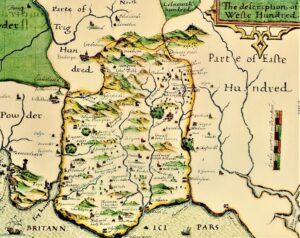
Ertach Kernow has been following several people living in different centuries on their travels around Cornwall. It is once again time to pick up the itinerary of cartographer John Norden, who travelled around Cornwall in about 1597. In his writings he had split Cornwall into a general history followed by descriptions of the nine hundreds, the historic administrative areas, with a map for each one. This week we look at West Wivelshire.
We previously covered Norden’s survey of Launceston and Saltash along with his mentions of a number of curiosities and ancient sites within the Easte Hundred of Cornwall in the December 2020 article. This can be read on our website. Over four hundred years ago some smaller towns, perhaps now villages, had far greater importance than now and some of our larger Cornish towns were mere hamlets. It is interesting to compare through the ages the descriptions and evolution of these settlements. As with many historic interpretations of even older sites errors and inconsistencies have come to light through modern science and subsequent discoveries.
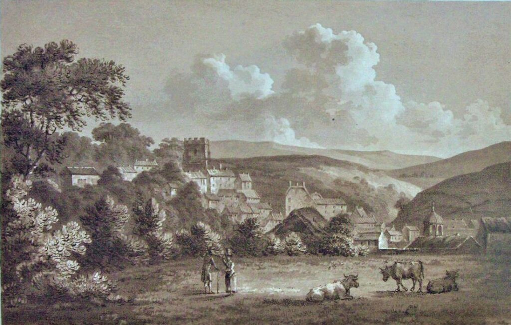
The Weste Hundred, also historically known as West Wivelshire, includes Liskeard which has been an important market town over a long period of time. It received its first charter from Richard Earl of Cornwall in 1240 and a castle, or probably a crenelated manor house built by Earl Richard existed here. This was virtually gone by the time John Leland visited in 1538. It looks from Norden’s description below that during his time Liskeard had seen better days and was much diminished from its previous level of importance and earlier high-status buildings. It did still retain its prominence as a coinage town but seems to have fared worse than other Cornish towns in the same situation.
‘Lyskerde, called the Borowe of Liskerde, for ther is the Mannor besides belonging to the Duchy and here had the Earles, and since the Dukes, a Castle and howse of residente, but now .decayd utterly; Ther was a parke also belonging to the Duchie, but K. Hen. the 8. cauled it to be disparked. It is but a poore towne, but a pretye market, and amonge others it is priviledged for the coynage of tynn: the towne is verie ruyned, as are also all the townes wherin the chiefe governors of Cornwall have in former times had their residence; and their longe absence hath bredd ruync and depopulation to the townes, to this above the reste, whole present ruynes argue her pristhne glorie to be greate.’
Richard Carew in his Survey of Cornwall published in 1602 confirmed Norden’s description writing; ‘Of later times, the Castle serued the Earle of Cornwall for one of his houses; but now, that later is worm-eaten out of date and vse. Coynages, Fayres, and markets, (as vitall spirits in a decayed bodie) keepe the inner partes of the towne aliue, while the ruyned skirtes accuse the iniurie of time, and the neglect of industrie.’
However, Liskeard picked itself up and in later centuries, some wonderful buildings were constructed, many of which happily still remain, and it again became a busy market town. Where the castle stood is now Castle Park.
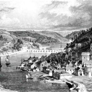
East and West Looe are also briefly mentioned as ‘two borowe townes united and knit together with a fayre, large, arched stone bridge, to which townes belongeth a pretie little harbour of the south sea’. Norden notes that the riverbanks are very high above the level of the river.
Polperro although a small village was mentioned by Norden due to the importance of its fishing industry. He comments ‘ Polperie or Polpera, a village and harbor situate between 2 hills, where much fishe is taken and vented to the fishdriuers, which they call Jowters’. During the Tudor period fish was a much-valued commodity and laws were passed at national and local levels protecting certain aspects of the fishing industry. The fishdriuers or Jowters were peddlers or hawker, especially of fish, who sold them from a cart.
Apart from the many references to smaller hamlets, Norden as with many other writers over the following centuries made reference to various houses and their owners. Some of these would have been quite impressive at the time, but it often a way of encouraging the said owner to subscribe to the book being published.
Natural places observed by Norden are few and far between in this hundred, but Norden notes; ‘Brown-Gellie a verie greate rock sett on the north-easte angle of the hundred, upon a loftie hill.’ Nearby Dozmary Pool is also mentioned, somewhat surprisingly is correct in many of its observations, which has many later stories that are untrue. ‘Dosmerye poole. A Stange or Poole on the topp of a greate hill, being aboue a mile in circuit, fed by no visible meane, nether had it anie issue seene, till of late yeares certayne tinners browghte an audite (as they call it) a watercourse out of their mineral out of this hill, wheron the poole standeth. It is at no place paste a fadome and haulfe deepe : It fostereth noe fish but Eeles. The chefest matter worth the obseruation is, that it standeth alofte a hill, and yet the poole seene litle to decrease in the greateste drowght, or to increase with rayne.’ Norden doesn’t mention the legend of King Arthur and Excalibur, this perhaps one of the later created myths.
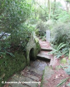
The holy well at St Keyne seems to have been of greater interest to Norden due to the tree that was said to have had one trunk, but the branches of four types of tree; oak, elm, ash and willow. There is no mention of the well building, built in the 16th century or the tradition that for a couple when a newly married, whoever drinks from the well first will be master of the marriage.
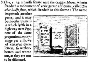
Monuments at St Cleer are mentioned, although not the holy well there, which we now know as the site of King Doniert’s Stone as well as ‘a monument of ‘verie greate antiquitie called The other haulfe stone.’ He mentions that the other part may be that near the highway near Fowey. This may relate to what is known as the Tristan Stone, which has been moved on several occasions, but there is no evidence that there is any connection whatsoever. Regarding King Doniert’s stone although Norden drew the stone he made no reference to it at all. This monument to the long dead Cornish King Dungarth was long forgotten even locally. C Hind Lewis visiting in 1906 had much trouble finding it, even from questioning local folk. Two young lads eventually pointed him in the right direction. In his book Days in Cornwall, he writes; ‘Together we climbed the hill, scrambled over a wall, and in a meadow near the leafy hedge that borders the road, known locally as the King's Field, were the two ancient monuments. There we remained for a quarter of an hour deciphering the inscription. The youths were silent when I said, ‘This king, so many centuries dead, has left a message. He entreats you to pray for his soul.’
The King Doniert Stone site, now managed by the Cornwall Heritage Trust, was enclosed and laid out at the cost of the Liskeard Old Cornwall Society in 1933. They also purchased the site of St Keynes Well and rebuilt the well house between 1934-1936.
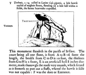
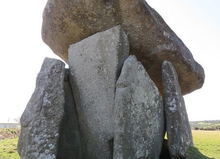
The other monument in St Cleer that Norden writes about is one of Cornwall’s most iconic dolmans, Trethevy Quoit. He is most impressed judging from his description and subsequent measurements. ‘Trethevie called in Latine Casa gigantis, a little howse raysed of mightie stones, standing on a little hill within a feilde, the forme hereunder expressed.’ His drawing is labelled with measurements. Obviously he had no idea of what it was or who had built this ancient stone edifice. This site has been one of great interest right up to the present day with recent excavations taking place there. Now days we are much better placed to understand and share the history of the many ancient stone sites throughout Cornwall.
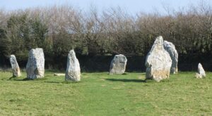
Although Norden mentions Duloe he does not mention the stone circle, Cornwall’s smallest with a diameter of just 12 metres. This makes it quite unique and was first recorded in the 14th century, but over time was lost and some stones incorporated into a hedge. Fortunately, it was recognised for what it was in the early 19th century and restored as far as possible as seen today.
John Norden produced some wonderful maps of all nine hundreds of Cornwall and his descriptions add to the historic record of Cornwall. Even the lists of houses and wealthy occupiers have a great value especially when added to the observations of other travellers both before and after his time.
![Dozmary Pool [3] Aerial view of Dozmary Pool](https://www.cornwallheritage.com/wp-content/uploads/2020/11/Dozmary-Pool-3-1024x403.jpg)
![Dozmary Pool [2] Dozmary Pool, Bodmin Moor](https://www.cornwallheritage.com/wp-content/uploads/2020/11/Dozmary-Pool-2-1024x556.jpg)
![[94] Voice - Ertach Kernow- 13.04.22A Travels around West Wivelshire [S] Ertach Kernow - Travels around West Wivelshire](https://www.cornwallheritage.com/wp-content/uploads/2022/04/94-Voice-Ertach-Kernow-13.04.22A-Travels-around-West-Wivelshire-S-230x300.jpg)
![[94] Voice - Ertach Kernow- 13.04.22B Travels around West Wivelshire [S] Ertach Kernow - Travels around West Wivelshire](https://www.cornwallheritage.com/wp-content/uploads/2022/04/94-Voice-Ertach-Kernow-13.04.22B-Travels-around-West-Wivelshire-S-229x300.jpg)
![[94] Ertach Kernow Heritage Column - 13th April 2022 - Celebrations of the Jubilee Ertach Kernow Heritage Column - 13th April 2022 - Celebrations of the Jubilee](https://www.cornwallheritage.com/wp-content/uploads/2022/04/94-Ertach-Kernow-Heritage-Column-13th-April-2022-Celebrations-of-the-Jubilee-283x300.png)