Ertach Kernow - St Veep a quiet once busy parish
St Veep celebrated their local saint day on 1st July, one of the many saints that most people in Cornwall have perhaps never heard of. Welsh records show that she is thought to have been a daughter or a member of the tribe of King Brychan of Brycheiniog during the 6th century. It does seem that St Veep’s gender is not definite and by the 14th century it seems the cult and interest surrounding the saint was well in the past.
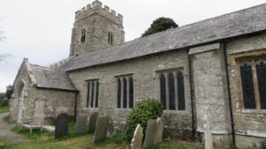
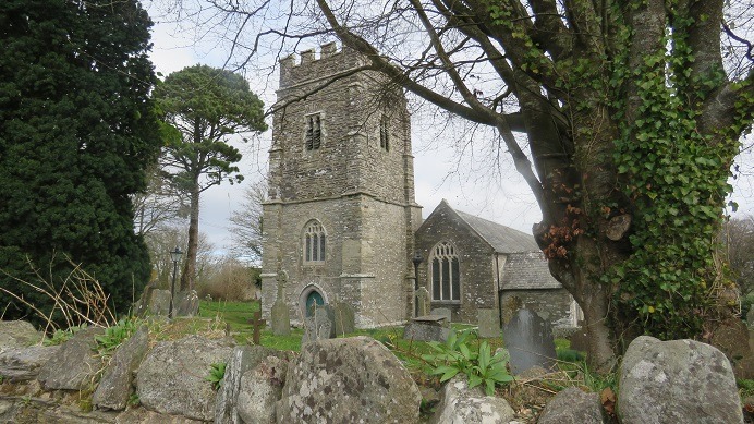
The original church dedicated to St Veep is recorded as owned by Montacute Priory in Somerset in 1269. Following church rebuilding in 1336 it was rededicated to Saint Quiricus and Saint Julietta, nothing remains of the earlier church and the only recognition to St Veep is the name of the hamlet and parish. The tower dates from the 14th century rebuilding, but the rest of the church dates from the late 15th through to the early 16th centuries. A special claim to fame for the church is its peal of six bells dating from 1770. When these were cast in the churchyard by famous bell casters Pennington and Company and came to be tuned they were found to be a virgin peal. This meant they were cast all perfectly tuned, the only set of bells like this in Cornwall and England. The tower and bells have recently been repaired and refurbished. The church also has a historic pipe organ that was extensively rebuilt in 1871 by J W Walker as recorded on the National Pipe Organ Register.
The Priory of Montacute also established a cell or small priory at St Cadix around 1100. Sold following the Reformation and converted into a residence In 1824 it was recorded by Hitchins & Drew in their History of Cornwall. That; ‘the site of the priory is well known and some ruins of the ancient chapel still remain. The abbey house and chapel are quite dilapidated, the cemetery turned into a garden and many of the stones are incorporated into adjoining buildings.' Today stones from the Norman period remain although no buildings exist.
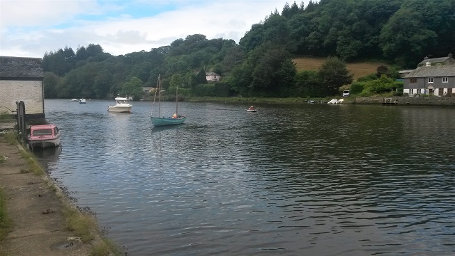
The population was just 319 in the last census, the parish does inevitably have a number of properties dedicated to the tourist industry. One side of the parish lies on the east bank of the River Fowey, the River Lerryn also runs through the parish. The main centre of population is the village of Lerryn, bisected by the river splitting it between the civil parishes of St Veep and St Winnow, also being the main population centre for the latter parish. The remaining population of this rural parish are scattered farms and the hamlets of Cliff, St Veep and Penpol.
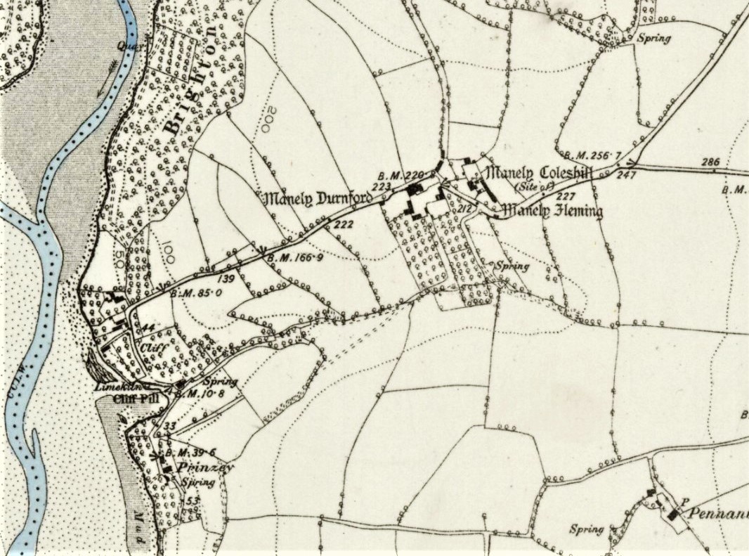
The parish as a whole has little evidence of ancient occupation with few prehistoric finds but some evidence of a Romano-Briton round and a barrow with scatterings of flints, but little more. By the post-Norman medieval period various settlements and occupation evidence can be found. Cliff, first named as a hamlet in 1361 as Cleve, lies close to the River Fowey on the confluence with the River Lerryn and it is this connection from which its origins perhaps lay. It is believed that there was a medieval river crossing here, a ford at low tide and a ferry during high tides. Early Ordnance Survey maps record paths on either side of the river and the importance of this crossing, one of the few between Lostwithiel and Fowey. This is illustrated by Richard Symonds a soldier in the King's Lifeguard during the English Civil War whose diary covers two years 1644-45, including the Lostwithiel campaign. He writes; ‘Satterday , 17. His Majestie attended with his owne troope, Queenes troope, commanded by Captain Brett , and sixty commanded troopers, went to Cliffe, a parish on this side of the river that runs to Listithiel, where Colonel Lloyd the Quartermaster Generall's regiment lyes to keepe the passe. The enemye keepes the passe on the other side at the parish of Glant.’
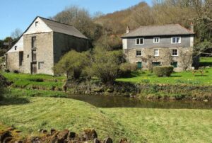
Penpol the other hamlet in St Veep parish was in fact three smaller hamlets named Higher, Middle and Lower Penpol mentioned in records in 1224 and again in 1249. Recently Lower Penpol the smallest has expanded and now merged with Middle Penpol. A corn mill with waterwheel was established at Lower Penpol by 1591 and rebuilt in 1794, the building remains are Grade II listed with the associated leat and two small footbridges nearby at Trebant and Tretalloc named in 1613.
Lerryn the largest settlement in St Veep Parish was first mentioned in 1284 when it is spelt Leryon. One claim to fame for Lerryn is, it’s at one end of what is known as the Giants Hedge of which an old rhyme goes, ‘One day, the Devil having nothing to do, built a great hedge from Lerryn to Looe’. Why this approximately nine-mile-long monument between the West Looe River and the River Lerryn was constructed is unclear, with many theories over the centuries. Dr William Borlase, the Cornish 18th century antiquarian believed it was part of a Roman road, other believe it is far older and may have been constructed during the Bronze Age, however more recently it is believed to have been a post Roman defensive ditch and rampart built by a local tribal group. This scheduled monument has some two miles protected, with two miles lost. At the best-preserved locations the bank is approximately 3.5m wide and up to 2m high whilst the ditch measures 3m wide and up to 0.8m deep. Parts of the Giants Hedge have been incorporated into roads and tracks.
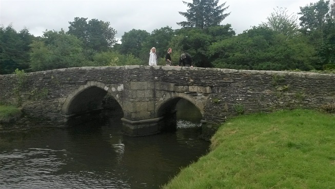
There has been a bridge at Lerryn for many centuries, the current bridge replacing an earlier bridge mentioned by John Leland in 1535. ‘Here goith yn a salt crek half a mile on the est side of the haven, and at the hed of it is a bridge caullid Lerine Bridge, and the creeke berith also the name of Lerine.’ In 1573 Queen Elizabeth ordered a levy on the rates for ‘erecting and re-edifying the decayed bridge called Laryon between St Vepe and St Winnow’. Originally a three arch bridge one was removed, probably through the river narrowing over time, which like many Cornish rivers due to silting from mine water pumped into the river further upstream. This is primarily a granite bridge and in good condition for its age. Lower Town Bridge at Lerryn a one arch bridge crossing a stream looks historic but is not, being built in the 19th century.
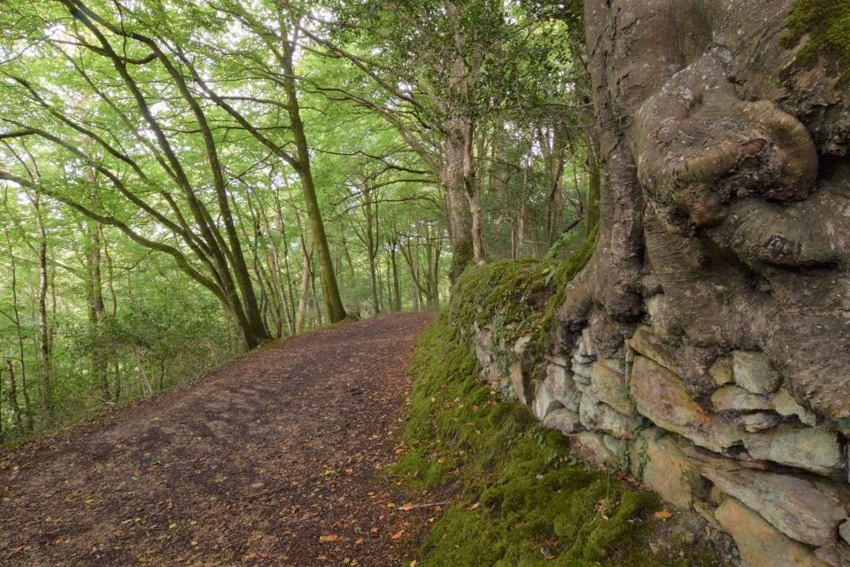
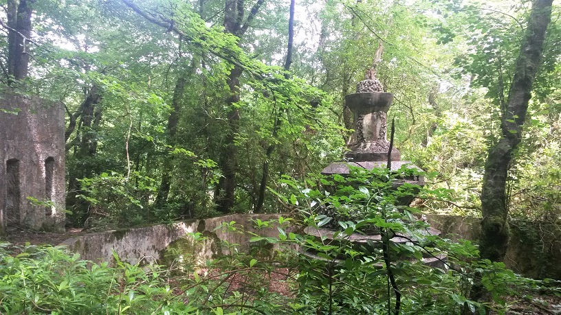
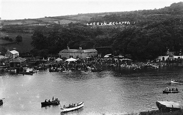
The outskirts of Lerryn contain wooded areas known as Lerryn Wood leading into Ten Acre Wood, Manley Wood, and then Brighton Wood along the River Lerryn. Close to the village within the wooded area is a most interesting feature of St Veep parish, known as the lost gardens of Tivoli Park. About 1920 Frank Parkyn a wealthy man who had made his fortune from his family china clay interests began building his version of the world-famous Tivoli Gardens in Copenhagen, which he had visited. It became in 1922 the regular venue for the sporting and fun element of Lerryn’s annual river regatta. The annual regatta, which Frank Parkin is attributed with having begun around 1870 was by all accounts a wonderful affair and described by some in the media of the time as the Henley of the West and ran until 1968. A description from nearly one hundred years ago in July 1924 gives a taste of what visitors enjoyed during the Lerryn Regatta at Tivoli Park. ‘The venue is approached by an artistically tiled entrance on which in blue tiles is the name ‘Tivoli Park’. A friendly clump of trees at once greets the visitors, from which opens out the sports ring, overlooking the Lerryn creek on the one side and surrounded by a thickly wooded plantation on the higher side. The picturesqueness of the park has been added to since last year by a further clearance where an oval space has been provided, fringed with a sanded path and shrubs. In this space the Stenalees Band entertained the company to popular selections. The rusticity of the scheme was heightened by a series of evergreen Grecian arches, with garden seats and tables sheltered by huge sunshades dotted about the ground. and fairy swings suspended from the trees. The park was encircled by 500 now flags, which imparted a touch of gaiety to the whole scene.’ Over the coming years much was added to Tivoli Park including fountains, pools and a pavilion. Frank Parkyn died in 1940 aged 90 and the park was sold to new owners then after the regattas ceased in 1968 the park gradually fell into ruin. Reclaimed by nature wandering around this former pleasure park one might wonder if anyone still remembers the torchlight parade and music that was one of the features of those delightful regatta events during Tivoli Park’s golden age.
Newspaper adverts from the 1830’s were clear to point out the advantages of being near Lerryn, where due to the navigable river manure could be obtained. This is what they termed sand and seaweed at those time and they also advised buyers that timber could be obtained especially oak for shipbuilding from the nearby woods. Lime was also available from lime kilns nearby producing lime for agricultural purposes. Articles and adverts from the 1840’s show Lerryn as an up-and-coming place to do business and live. Now a relatively quiet backwater it is a scenic place to visit, enjoy the river views and explore the lost Tivoli Park along with other places throughout this small attractive parish.
![Ertach Kernow - 12.07.2023 [1] St Veep a once busy quiet parish](https://www.cornwallheritage.com/wp-content/uploads/2023/08/Ertach-Kernow-12.07.2023-1-scaled.jpg)
![Ertach Kernow - 12.07.2023 [2] St Veep a once busy quiet parish](https://www.cornwallheritage.com/wp-content/uploads/2023/08/Ertach-Kernow-12.07.2023-2-scaled.jpg)
![[159] Ertach Kernow Heritage Column - 12th July 2023 - Ertach Kernow Heritage Column - 12th July 2023 - Lafrowda Festival, Holyer an Gof awards, Polperro Fishermen's Choir](https://www.cornwallheritage.com/wp-content/uploads/2023/07/159-Ertach-Kernow-Heritage-Column-12th-July-2023-1-1-280x300.jpg)