Ertach Kernow - Tudor Travels, Leland around Cornwall's Roseland Peninsula
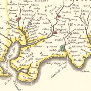
One of the earliest travellers through Cornwall was John Leland, last October we looked at the start of his journey through Cornwall in the year 1542. Looking at his comments and writings provides an important contribution to Cornish historic heritage. We last left John having travelled through Launceston, Boscastle, Bodmin and through many smaller settlements at the time to Truro and then onwards down the Fal. However, Leland did not necessarily travel to a well-defined plan or map and revisited different part of Britain, including Cornwall at differing times. I will try to put it in some semblance of order, although this was not the order necessarily travelled by Leland but may be better in illustrating his thoughts and notes on areas of Cornwall to the reader.
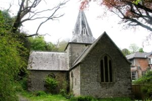
Leaving Malpas and the attack by the Spanish behind us we join John on his journey down the Fal where he mentions Lan Moran creak and the church of St Moran. This is a small 13th century granite faced killas stone constructed cruciform church. It had already received early rebuilding work in the 14th century and subsequent interior reconstruction during the 19th century. The church is grade II listed, as it the detached belfry and is currently closed due to being taken over by various species of bats.
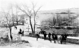
Travelling up to Tregony Leland describes the 14th century bridge and from his notes it was seemingly larger, with multiple arches, than today’s bridge. He mentions Tregony as a market town, but Tregony was also once a substantial port and a populous thriving town called Trefhrigoni, mentioned in a charter dated 1049 and again in Domesday in 1087. Before the Great Reform Act of 1832 Tregony returning two members of Parliament and was one of the numerous Cornish rotten boroughs swept away by that act of parliament. Construction of the bridge in the 14th century caused the river to rise and eventually flood the 11th century church, which was abandoned by 1538. However, during Leland’s visit he mentions the old castle and parochial church of St James, which must have been standing at around 1542, but is now completely buried.
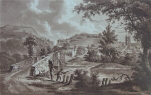
Leland then mentions St Austell and its bridge. ‘St Austol’s a poore village with a paroche chyrch us vi myles east fro Tregony.’ He does say that the river that runs on the west side of the hill on which St Austell stands is a “praty river”. That’s it for St Austell from Leland I’m afraid. St Austell was granted a market in 1661 and later three fairs, it grew and prospered especially from its close vicinity to the Polgooth tin mine. The earliest Polgooth Mine records are dated 1593 and during the 18th century it became known the richest mine in Britain.
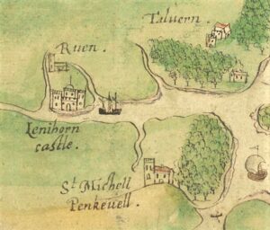
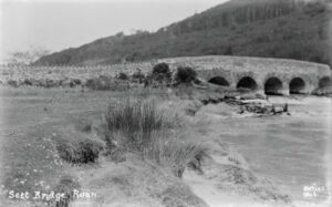
Leland briefly mentions Grampound and then goes on to mention Ruan Lanihorne at the head of a small creek. Interestingly here he mentions one of Cornwall’s lost castles ‘At the hed of this creeke standith the Castelle of Lanyhorne sumtyme a castel of a 7 tourres, now decaying for lak of coverture. It longgid as principal house to the archedecons.’ The Sett Bridge at Ruan Lanihorne was not built until about 1850 and passage across the river here appears to have been via a weir in Leland’s time. The ancient castle built by the le Ercedekne family around 1100 was an adulterine castle, built without consent, although later in 1334, Edward III granted a licence for crenelation. It had a round tower and cellars used as a dungeon and brewery and was demolished during the 19th century. This was just one of the many manors held by the le Ercedekne family in Cornwall and although the manor at Ruan was not the largest it was the seat of their power.
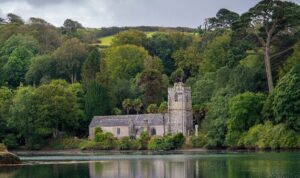
Next port of call for Leland was St Just in Roseland where he merely mentions the church in passing. Now a place visited by countless people every year and was described by Poet Laureate John Betjeman as ‘to many people the most beautiful churchyard on earth’. The church is of 13th century construction and was dedicated to St Just in 1261. The existing church was built on the site of an earlier 6th century Celtic chapel. The gardens are a recent 19th century addition.
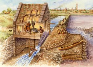
Leland then mentions the St Mawes Creek ‘and on this point stondith as yn the entery of S. Maws Creek, wher is a castelle or forteres late begon by the king.’ The castle wouldn’t be finished until the reign of Henry VIII son Edward VI. He continues on and comments ‘Scant a quarter of a mile from the castel on the same side upper into the land is [a] praty village or fischar toun witha p[ere] cawllid S. Maws, and there is [a cha]pelle of hym and his chaire of stone a [litle with]out, and his welle. They caulle this sainct there S. Mandite, he was a bishop in Britain and paintid as a schole-master. Half a mile from the hedde of this downward to the haven is a creke [in man]Jner of a poole with a round marke made in th[e] charte on the which is a mille gr[inding] with the tyde.
This is interesting in that watermills and windmills are well known, but also around the coast there were a number of tidal mills using the power of the tide to turn the wheels to grind grain. Today we look to utilise the power of the tide as part of a modern renewable energy programme. Five hundred years ago they were using tidal power that did not rely on wind, rainfall, rivers and leats to run many mills.
One of the matters Leland was interested in apart from the numerous creeks that he was keen to mention was woodland. The value of Carrick Roads as a harbour that required protection by building two castles was recognised by Henry VIII as was woodland. Leland noted that; ‘All the crekes of Fala welle woddid.’
The Priory of Plympton, the wealthiest in Devon, owned land in Cornwall and had established a church at St Anthony in Roseland along with a small priory. On the dissolution of the monasteries during the late 1530’s the priory at St Anthony’s was closed and the site later became residential with much of the stone being used to build St Mawes Castle. The Church remained in being but became very dilapidated until restored by the Spry family during the 19th century. Leland makes mention of the former priory it having been dissolved by the time of his visit.
At this point of what seems a somewhat round trip on this occasion Leland turns east towards St Austell and not across the estuary to Falmouth and Pendennis Castle. Whether he had already visited or would visit Falmouth on a later trip we will look at this part of his itinerary at a later date. What is interesting about this part of his tour is that there are no major towns included and St Austell now a far larger town than historic Bodmin is only a poor village. The following four hundred years would see a huge transformation of Cornwall as its industrialisation takes place, creating huge wealth and transforming small villages into major settlements. It would also see some wealthy towns start to diminish as their historic industries begin to fail and their river systems become silted up through the effects of mining.
The first part of John Leland’s itinerary covered in Ertach Kernow is number 17 on the index 21st October 2020 found on the website at www.cornishheritage.com under newspaper blogs in the top menu.
![[56] Voice - Ertach Kernow- 210721A Tudor Travels [S] Ertach Kernow- Tudor Travels, John Leland around the Roseland Peninsula c1542](https://www.cornwallheritage.com/wp-content/uploads/2021/07/56-Voice-Ertach-Kernow-210721A-Tudor-Travels-S-226x300.jpg)
![[56] Voice - Ertach Kernow- 210721B Tudor Travels [S] Ertach Kernow- Tudor Travels](https://www.cornwallheritage.com/wp-content/uploads/2021/07/56-Voice-Ertach-Kernow-210721B-Tudor-Travels-S-230x300.jpg)