Ertach Kernow - Cornwall's Turnpike and Toll Roads
As we enter summer with bookings at an incredible high, if reports are to be believed, our Cornish roads will be chock a block with campers, caravans and oversized cars many getting stuck in our narrow winding Cornish side roads and lanes, as drivers follow their sat navs unquestioningly.
Spare a thought for how things were in the past. Some readers may still remember the difficulties getting out of, and around about in Cornwall over 60 years ago. What about longer ago than that? No wonder that the smaller 19th century harbours and ports around the Cornish coast were kept so busy with schooners and ketches plying the coastal maritime trade and avoiding road transportation wherever possible. The railways would help put an end to that trade and would bring tourists into Cornwall in huge numbers. By the 1960’s better vehicles led to a decline in railway numbers, but with cars and buses much smaller and slower than today it wasn’t such problem outside of town centres.
Going back in time two hundred years Mrs Loveday Gregor, an acquaintance of the Cornish entrepreneur J T Treffry, wrote in her diaries commenting on the state of Cornish roads during the period of her childhood around 1800. She wrote, they were the worst in England being left entirely to nature or mended with great blocks of stone. In winter they were nearly impassable. Wagons were rarely seen and almost everything was carried on mules. Men moved about on horseback attended by their grooms. However, it wasn’t until roads had improved into the 19th century that Cornwall saw greater use of wagons and carts on roads and a decline in use of mules.
Manorial responsibilities had declined from the 16th centuries and power had gradually been taken over by Parish Vestries. These included the upkeep of roads along with maintaining poor laws. Roads became a much lower priority as the latter became the Parish Vestries main duty. These secular requirements were gradually withdrawn during the 19th century.
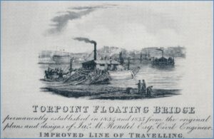
Until the later 18th century there were just two major roads running through Cornwall, the northern land post road that ran via Launceston and the southern Torpoint to Truro route including a ferry passage. Since 1791 an act of Parliament had regulated the ferry across the Tamar and led to investment in the southern route with an increased amount of coach travel. James Rendel successfully created the steam operated chain ‘floating bridge’ ferry at Torpoint, increasing traffic further. A further coastal road scheme that would have included towns such as Fowey came to nothing, adding to their 19th century decline.
Throughout England there were numerous schemes to improve roads through the introduction of Turnpike Trusts that maintained the principal roads. These trusts were each set up through individual acts of Parliament, with the first ones created through the Turnpike Act of 1707. There would eventually be over 1,000 individual trusts covering 30,000 miles of roads throughout England and Wales by 1830. Although these helped improve roads they were not always popular with local people, such as farmers, who needed to access their land from those roads and were charged for the privilege.
As usual Cornwall was late to the turnpike party due to its relative isolation, with the first Cornish turnpike act not being passed until 1754 for Truro Road. In 1760 the Launceston Turnpike Trust was established covering roads within north east Cornwall and linking with those in west Devon. This helped improve the northern post road with other roads being added through acts of Parliament up to 1815. Numerous Cornish towns would create individual turnpike trusts to improve roads and in 1769 the Bodmin Turnpike Trust was established that covered the main central route over Bodmin Moor. The Bodmin trust would add other roads in the area through further acts of Parliament between 1811 and 1866.
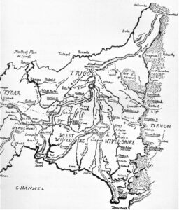
By 1770 three main access points to Cornwall existed, through Launceston, Callington and via the ferry at Torpoint. It would take time for the roads to improve from their pre-turnpike days as evidenced by Mrs Gregor’s diary comments about Cornish roads, but great improvements had been made and many tens of thousands of pounds invested by the various trusts.
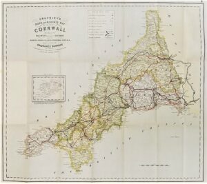
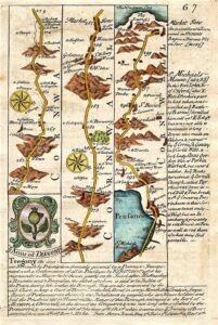
As road access improved there were numerous maps produced that helped show travellers places throughout Britain, which increasingly included the names of small communities. In Cornwall, Newquay would appear for the first time in 1748 with Thomas Martyn’s map, whilst other cartographers like Emanuel Bowen would produce strip maps showing the terrain along the roads. Books with Contour road maps would also be produced by Harry Inglis for example. These helped those using the roads to ascertain the steepness of routes between various towns. Cornwall is included in the Western Division of Contour Road Book of England that included 500 maps.
Along with the Cornish coastal marine trade and the canal system throughout England, the coming of the railways had a huge impact on the turnpike trusts. The opening of the Royal Albert Bridge joining the railway lines in England to those in Cornwall in 1859 led to greater passenger travel by train. Winding up the various turnpike trusts In Cornwall came about from the 1860’s when various parliamentary acts expired and were not renewed. Other factors had also contributed to fall in receipts from 1851, such as conversion of a daily stagecoach to a mail coach which then became exempt from the toll.
One of the legacies of the turnpike trusts in Cornwall are the 50 or so Cornish Toll Houses that still remain. There were originally about 180 of these along Cornwall’s turnpike roads where a gate was positioned so the toll keeper or toll collector could live and collect the road tolls from road users.
The individual Parish Vestries had their responsibility for roads, which were not controlled by turnpike trusts, removed through the Highways Act of 1862 by creation of Highway Districts. Main roads were created from former Turnpike Trust by The Highways and Locomotives Amendment Act of 1878, Cornwall’s being passed to Cornwall County Council through the creation of an Administrative county in 1888. The Local Government Act of 1929 transferring all road maintenance responsibilities to County Councils.
Only from the 1970’s were Cornwall’s main roads gradually brought up to a standard that met those of our Devon neighbours and others in England, with many smaller communities and narrow roads being bypassed. 2017 saw the most recent part of the A30 completed at Temple with further improvements now taking place between Chiverton Cross and Carland Cross.
Cornwall has taken over 300 years since the first turnpike trusts were established to improve British roads, and raising the central Cornish main road to modern specifications. This is happening ironically just as climate change increases pressure on society to reduce road use. Happy travelling whilst you can.


![Emanuel Bowen [1694-1767] Road Map Emanuel Bowen [1694-1767] Road Map](https://www.cornwallheritage.com/wp-content/uploads/2021/05/Emanuel-Bowen-1694-1767-Road-Map-300x233.jpg)
![Route 764 Newquay to St Austell [1900] Route 764 Newquay to St Austell [1900]](https://www.cornwallheritage.com/wp-content/uploads/2021/05/Route-764-Newquay-to-St-Austell-1900-1024x180.jpg)
![Route 758 Truro to New Quay [1900] Route 758 Truro to New Quay [1900]](https://www.cornwallheritage.com/wp-content/uploads/2021/05/Route-758-Truro-to-New-Quay-1900-1024x166.jpg)


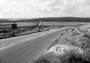
![[45] Voice - Ertach Kernow-050521A - Cornish routes [S] Ertach Kernow - Cornish routes](https://www.cornwallheritage.com/wp-content/uploads/2021/05/45-Voice-Ertach-Kernow-050521A-Cornish-routes-S-236x300.jpg)
![[45] Voice - Ertach Kernow-050521B - Cornish routes [S] Ertach Kernow - Cornish routes](https://www.cornwallheritage.com/wp-content/uploads/2021/05/45-Voice-Ertach-Kernow-050521B-Cornish-routes-S-230x300.jpg)