Ertach Kernow - Bodmin’s Hillforts at Castle Canyke and Dunmere
Bodmin’s Hillforts at Castle Canyke and Dunmere - With Bodmin, situated fairly centrally in Cornwall it’s not a long journey to visit some of Bodmin and Bodmin Moors areas of historic interest, churches, holy wells, ancient crosses and much else. Local folk and visitors looking for sites and places to visit have an abundance to chose from. So, with spring and hopeful escape from lockdown imminent let’s take this opportunity to look at a couple of these now and in future editions, to add to exercise and daytrip lists of possible places to visit.
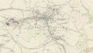
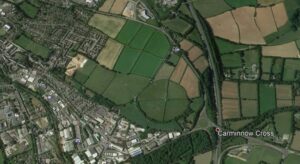
Sadly, most of the prehistoric sites in and around Bodmin town have been obliterated, but there are many interesting sites close by. There is documentary and place name evidence of these other ancient sites and structures within the Bodmin town area, along with some extant barrows and evidence of these from maps and aerial views of vegetation growth.
The two sites fortunately remaining are just outside the town. Castle Canyke’s use for military purposes is recorded as being the meeting place for Cornishmen leading to what would become popularly known as the Prayer Book Rebellion, but perhaps more accurately The Western Rising or Western Rebellion. The year was 1549 and religious issues, dissatisfaction and events had led to men gathering as part of a rebellion. The leaders of the revolt had gathered in Bodmin and then made their way to ‘the old British fortress known as Castle Kynock’ as described by Frances Rose-Troup in her book ‘The Western Rebellion of 1549’. A small group sent by Humphrey Arundell of Helland, who had been appointed General, had taken St Michaels Mount and returned to Castle Kynock flushed with success, where some 6,000 men had met and were undergoing training. They left Castle Kynock with cheers and banner flying to march towards their ultimate defeat and doom at Battle of Sampford Courtenay and the retreating action at Okehampton.
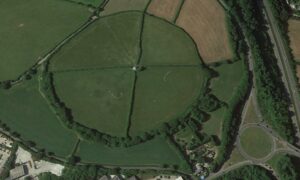
Castle Canyke Iron Age hill fort is not as well-known as many of the other prehistoric hill forts and cliff castles around Cornwall, it is however the largest covering some 18 acres. It lies close to the main thoroughfare that ran through Cornwall from historic times and still does as the A30 and A38. Perhaps a reason for its location.
First mention of Castle Canyke is believed to have been made by an early traveller around Cornwall, William Worcester or often known as William Botoner. He travelled around the south of England and Cornwall during the late 1470’s making notes on places he visited, unfortunately not published in any great extent. This site was not mentioned by either of those other early antiquarians and cartographers William Camden or John Norden. The Lyson brothers ‘Magna Britannica – Cornwall’ published in 1814 mentions that William had visited and noted ‘Ceiellum de Keynock, dirutum, cum tribis wardis’ perhaps indicating that there were three defensive circles. This was confirmed by a footnote in Polwhele’s History of Cornwall ‘Bodmin town, on the east part thereof, on a high mounted hill, hath still extant the ruins of a British treble intrenchment, containing about twelve acres of ground, still commonly called Castle Kynock, alias Cunock, synonymous words, signifying the king, or supreme and sovereign castle.’ There are suggestions of Arthurian connections with this site as a candidate for Kelliwic (Celliwig)
We are indebted to Sir John Maclean in his Parochial and Family History series of books and the Bodmin edition published during the early 1870’s for a description of Castle Canyke, also called Castle Kernick together with a drawing as follows.
“Primeval Antiquities - There are within the parish of Bodmin two considerable encampments or hill castles, the most important of which is Castle Canyke, about one mile south-east of the town. The other is situate in Dunmere Wood, about two miles on the north-west side.
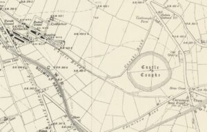
Castle Canyke. This entrenchment, which is situate on the crest of a hill, contains in area about is acres, and is nearly circular. (See 1'1. V. fig. I.) There appear to have been two ramparts, but they are now nearly obliterated. The entrance seems to have been on the south side, but so many breaches have been made in the rampart that it is difficult to speak with precision. About 300 yards on the west of the camp was a tumulus, which was probably a place of sepulture. Such tumuli are frequently found near the camps in Cornwall. The land upon which this camp is constructed was common until within the last forty years, about which time it was inclosed, and hedges have been made to intersect the castle itself. The height of this above the level of the sea is 520 feet, being, Mr. Wallis observes, the exact height of the great pyramid of Egypt from the ground. It commands an extensive view. In the valley below, on the south-west, close to Halgaver Moor, is a ravine called the "Dragon Pit."
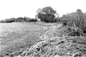
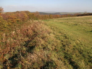
The Ordnance Survey map of 1813 shows Castle Canyke as a large bivallate (two circles) fort. First surveyed at a large scale by Maclauchlan in 1847, his plans showed the outer rampart entire but the inner degraded to a simple scarp for most of its length. The entrance was possibly on the south-west but "there are so many breaches in the rampart it is difficult to say precisely". The later ordnance survey map of c1880 clearly shows three defensive rings, with that appears to be a possible entrance to the south west. However, much of this is now lost through agricultural mistreatment over a long period.
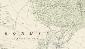
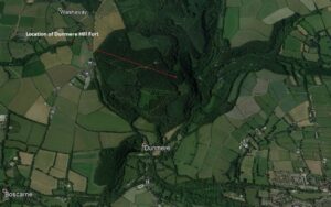
Sir John Maclean continues with the Dunmere Wood antiquity. ‘This entrenchment has a single vellum of an irregular oval form (see Plate V. fig. II.), and a ditch varying front 8 feet to 18 feet in depth, having only one entrance, which is on the north-east. It commands the valley of the Alan. On the eastern side, for nearly one-half of its circumference, it is skirted by an ancient road or track, leading on the north towards Pencarrow, and extending on the south in a south-easterly direction.’
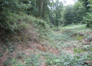
The Dunmere hill fort area is rather overgrown and has been for hundreds of years. Its estimated dating is between the late Bronze Age and early Iron Age (eighth - fifth centuries BC) and is thought to have been used for 150 to 200 years prior to abandonment. Description from the Historic Environment Record states; ‘The monument includes a slight univallate hillfort, situated on the upper south eastern slopes of a prominent hill, and at the top of the steep western valley side of the River Camel. The hillfort survives as an oval enclosure measuring approximately 180m long by 135m wide defined by a single rampart bank of steep profile and up to 3m high and a rock cut outer ditch of up to 2m deep with near vertical sides in several places.’ The name Dunmere would have probably originated from the Celtic word Dun for fort or perhaps fortified place, linked to this ancient site.
Cornwall has a good number of fortified sites and these will be looked at in future articles.
![Castle Canyke inner bank south west side of the settlement by Mike H [Megalithic Portal] Castle Canyke inner bank south west side of the settlement by Mike H [Megalithic Portal]](https://www.cornwallheritage.com/wp-content/uploads/2021/02/Castle-Canyke-inner-bank-south-west-side-of-the-settlement-by-Mike-H-Megalithic-Portal-300x277.jpg)
![Castle Canyke - Sir John Maclean [Drawing] Castle Canyke - Sir John Maclean [Drawing]](https://www.cornwallheritage.com/wp-content/uploads/2021/02/Castle-Canyke-Sir-John-Maclean-Drawing-270x300.jpg)
![[32] Voice - Ertach Kernow-030221A - Taking the High Ground - Bodmin Hill Forts [S] Ertach Kernow - Taking the High Ground - Bodmin's Hill Forts](https://www.cornwallheritage.com/wp-content/uploads/2021/02/32-Voice-Ertach-Kernow-030221A-Taking-the-High-Ground-Bodmin-Hill-Forts-S-229x300.jpg)
![[32] Voice - Ertach Kernow-030221B - Taking the High Ground - Bodmin Hill Forts [S] Ertach Kernow - Taking the High Ground - Bodmin's Hill Forts](https://www.cornwallheritage.com/wp-content/uploads/2021/02/32-Voice-Ertach-Kernow-030221B-Taking-the-High-Ground-Bodmin-Hill-Forts-S-231x300.jpg)