Mapping Methodism: Profiling the Heritage of Cornish Chapels
Christianity and place have been closely connected in Cornwall since the middle decades of the eighteenth century through the rich heritage of Methodism. It is a connection that is still symbolised today by the physical presence of town and village chapels and Cornish Story is now working in partnership with both the Federation of Old Cornwall Societies and the Methodist Church to create a series of profiles of both existing and former religious sites. Entitled ‘Mapping Methodism’, the project team led by Tony Mansell and Garry Tregidga would like to hear from volunteer researchers who would be interested in the study of chapels and other related sites (e.g. outdoor preaching pits) at the local level. The immediate task is to create a series of historical timelines on individual sites with relating information on any books, films or other media. A template can be provided along with advice on researching the subject. The aim would then be to disseminate this information through digital platforms and use this project as a catalyst for further research in relation to the Methodist heritage of Cornwall
Mawla Wesleyan Chapel
By Clive Benney & Tony Mansell
Nationally
1739: Founded by John & Charles Wesley and George Whitefield within the Church of England.
1797: Split from the Church of England to become a separate body.
Suffered from many splits.
1932: Amalgamation of the Wesleyans, Primitives and the United Methodist Church to form the Methodist Church of Great Britain.
Mawla
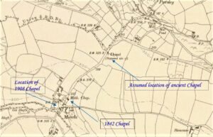
1805: Lysons referred to the remains of an ancient chapel at Mola.
1842: Mawla Wesleyan chapel built with seating for a congregation of 120.
The chapel was also used for the Sunday school.
The chapel was “by the side of the high road to Menagissey, about half a mile beyond Mawla Farm”. (Maurice Bizley)
1847: Mr Newton recorded in a paper to the Royal Institution of Cornwall that Mawla Chapel was 25 to 30 feet long by 16 feet wide and had recently been used as a cows’ house. He said that the font together with all the other remarkable parts of the building were gone. (Presumably this is the chapel referred to by Lysons)
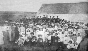
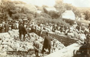
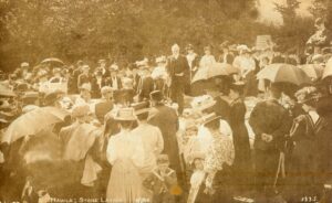
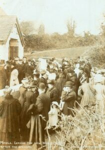
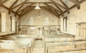
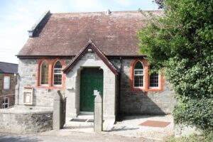
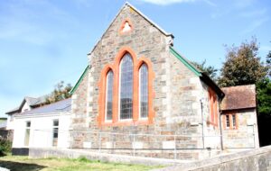
1908 – 8th July: Foundation stone laid for new chapel.
1909: Opening of new chapel.
The 1842 chapel continued to be used for the Sunday school when services transferred to the 1908 chapel about 50 yards away.
The 1842 chapel was considered unsafe and demolished.
Peter Simmons of Mawla, whose family farmed the field in question, recalled pieces of foundation being removed from the field, appropriately named Chapel Croft. (We are unsure if this refers to the chapel mentioned by Lysons or the 1842 chapel)
