Ertach Kernow - Cardinham a parish full of history
Cardinham a well-known name probably because of the 650 acres of woodlands which are well visited throughout the year. This parish at 9,612 acres is one of the largest in Cornwall but sparsely populated with just 595 people registered in the 2021 census. Virtually entirely rural the majority of the population reside in the village of Cardinham and hamlet of Millpool the remainder in smaller hamlets, farms and isolated homes throughout the parish. Just under a third of the parish to the north is included within the Bodmin Moor Area of Outstanding Natural Beauty (AONB) and the parish has a wide range of prehistoric, early and late medieval sites and monuments recorded.
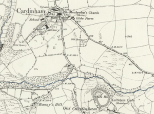
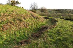
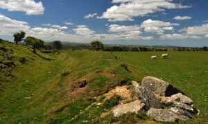
The name Cardinham, or Kardhinan in Kernewek, derives from the two-word parts Kar and Dinan both meaning fort or place of little fort. However, there are suggestions from the 19th century archaeological surveyor Henry MacLaughlan that the family that became known as Cardinan originated from the Breton town of Dinan prior to the Norman Conquest when Brittany was a vassal state to Normandy. However, the late 20th century academic Miss E M R Ditmas and others are not convinced. Following the Norman conquest what is now known as Old Cardinham Castle was built around 1080. This was a motte and bailey castle believed to have been constructed by Richard Fitz Turold son of Turold. He is deemed to have been in the retinue of Robert of Mortain the half-brother of William I who held most of Cornwall on behalf of the King. It seems that Turold had been granted 28 estates in Cornwall by Robert of Mortain, his son Richard followed him holding what became known as the Honour of Cardinan. Much of the estate continued within the family for over 300 years. In due course they would relocate to the larger Restormel Castle, originally established during the 12th century, from Cardinham and gradually the motte and bailey castle was left to decay. What can be seen today is a motte some four metres high with much damage at the top and east side by surface stone scavenging. Some rebuilding in stone had taken place with surveys and excavations in 1878 and 1920 recording a lime-mortared wall and Pentewan stone. Nothing now remains. The bailey rather better preserved on the west and south sides, but the east side has been cut away. The 16th century antiquary John Leland visiting Cornwall around 1540 mentions Cardinham Castle but makes little of it, likely a total ruin by that time.
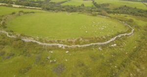
An earlier fortification is the larger prehistoric Iron Age hillfort Bury Castle some 1.5 miles northeast of Cardinham. Ernest Axford describes it in his topographical book ‘Bodmin Moor’ published in 1975 so; ‘Bury Castle, above Cardinham, is . . . . situated below the highest point of the ridge on which it stands, but this is a more important fortification than the earthwork in St Neot. It is larger and its ramparts are higher. To the east and southeast the land falls steeply to a small stream. On this side the enclosure is guarded by a single bank and ditch. On the west where the land slopes gently upwards, the fort is guarded by additional ramps and ditches of which only scanty traces remain.’ This was clearly an important prehistoric site and can be walked to from the village, with a footpath running next to the hillfort with splendid views from the top.
Throughout the parish there is evidence of early Iron Age to Romano British rounds and field systems. Rounds or small groupings of round houses emerged from about 400BCE, the beginnings of small farmsteads or hamlets enclosed by a bank or ditch. There is thought to be some 2,500 of these in Cornwall, most are lost but remains can be picked out by aerial photography and ground penetrating radar. Use of rounds in Cornwall lasted into the 6th century after their use had tended to die out elsewhere in Britain.
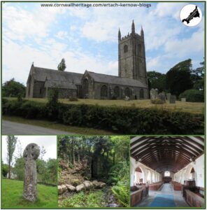
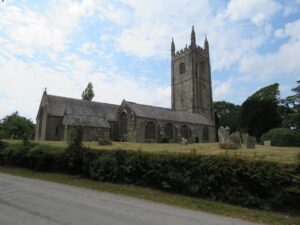
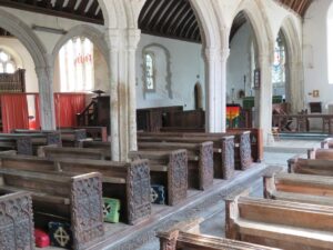
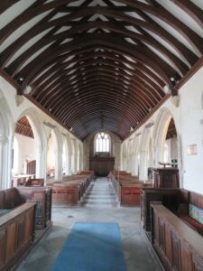
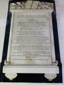
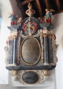
The medieval church of St Meubred is Grade I listed and was rebuilt during the 15th century. The early antiquarian William of Worcester commented that ‘The body of St Mybbard the hermit (son of a King of Ireland) otherwise called Colrog, lies in a shrine in the Church of Kardynan. 2 miles from Bodmin. His day is kept on the Thursday next before Pentecost.’ The church wasn’t thankfully heavily restored and ruined by enthusiastic restorers during the 19th century when many churches saw interesting and historic features destroyed. Charles Henderson tells us ‘In 1822 the Rector Thomas Grylls refused to comply with the Rural Dean’s order to tunnel the roof with plaster, on account of the woodwork being handsomely finished.’ Nave and aisles have benches with C15 carved bench ends, many include the arms of the Glynn family. There is a magnificent Glynn monument in the south aisle dated 1699 by Denny Glynn memorialising members of his family. Throughout the church there are various other marble and slate memorials including to the saviour of the timber ceiling Thomas Grylls dated 1845 who was well-loved by his parishioners over his 31-year tenure.
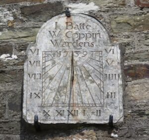
Over the church porch is a sundial with I Batte and W Coppen, the names of the church wardens, engraved along with the date 1739. Sundials are often overlooked for other aspects of church construction but are a reminder of times when for ordinary folk telling time with reasonable accuracy depended on the sun. Each one needs to be specifically angled and placed, depending on the position of the church, and are usually found above the porch providing better access to sunlight. Relying on these for accuracy is now not perhaps advisable, often the metal gnomons will have lost some of their length through corrosion. The sundial at St Meubred is somewhat nibbled around the edges but remains a nice memorial to the people and earlier times.
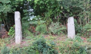
Within the churchyard there is a granite wheelhead cross dated to about the 10th century about two metres tall, this is considered by many as one of the finest in Cornwall. The other interesting monument is the tall stone, which is an inscribed memorial stone with a medieval wayside cross mounted on it. The inscription reads `Rancori fili Mesgi' which translates as `Rancorus son of Mesgus', the wording indicates it is likely sixth or seventh century. There are a number of historic stones throughout Cardinham Parish including two further inscribed stones at Welltown. The first approximately 1.5 metres tall with the inscription 'vailathi fili vrochani' (Vailithus son of Vrochanus) this had stood beside an outbuilding until rescued. The second had been used as a gatepost and has the inscription 'ORATE PRO EP iScopus Titus' as recorded by Professor R. A. Stewart Macalister the esteemed Irish archaeologist in his ‘Corpus Inscriptionum Insularum Celticarum’ published in 1945. Since placing these stones at their current site there has been a huge amount of growth and in 2022 Anne Preston-Jones, Andrew Langdon and landowner Andrew Hammond carried out clearance work around the stones. Anne also arranged photogrammetry on the stones to create a 3D image and uncover fine geometric details, see an example on our website. More people really need to get involved with clearance activities to help preserve endangered Cornish heritage. This can be done through Cornwall Archaeological Society, Historic England and other smaller local organisations such as Newquay Old Cornwall Archaeological Group. A number of Old Cornwall societies carry out clearance work at historic sites and this should be considered just as important as perhaps picking up plastic from beaches and other environmental tasks.
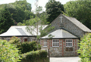
There were two Methodist chapels in Cardinham parish with the oldest at Millpool built in 1860. This was enlarged in 1991 with the addition of a large Sunday School, now used as a community hall and hosting many events and activities. The second chapel at Cardinham was built in 1932 and closed in 1996 and now occupied as a private residence.
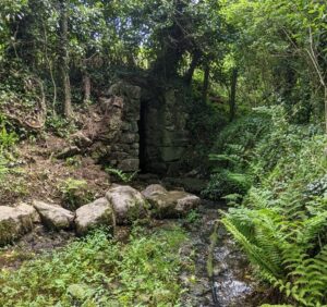
The Trezance Holy Well can be found on the road north from Cardinham village towards Millpool, just before Trezance Farm along a grassy path. A short way along surrounded by trees there is access across stepping-stones to the large granite block well house built during medieval times, one of the largest in Cornwall. This has a stream flowing from it and water from it was until the mid-19th century used in local baptisms. Adjacent to the well are stone and earth banks, all what remains of the site of a chapel which once stood here. Now long vanished the chapel’s stones were used in nearby farm buildings. The area forming Trezance Holy Well, and chapel enclosure are protected as scheduled monuments on the National Heritage List.
Hopefully visitors to the woodland will take the opportunity to look elsewhere throughout this parish during their next visit. It’s always a pleasure to find local parishes where dedicated folk produce a regular local newsletter or magazine, especially when they share it online as a pdf. Cardinham is one of those with theirs produced every other month containing local news from within their community. Besides local residents parish and village newsletters are often of interest to people far and wide including potential visitors, those with family connections and those interested in Cornwall generally . Well done to those producing and sharing the Cardinham parish newsletter online and all those throughout Cornwall who do the same in their own area.
![Cardinham Church Cross [1] Cardinham Church Cross](https://www.cornwallheritage.com/wp-content/uploads/2023/09/Cardinham-Church-Cross-1-225x300.jpg)
![[168] Ertach Kernow Heritage Column - 13th September 2023 - Gorsedh Kernow bars initiated and awards Ertach Kernow Heritage Column - 13th September 2023 - Gorsedh Kernow bars initiated and awards](https://www.cornwallheritage.com/wp-content/uploads/2023/09/168-Ertach-Kernow-Heritage-Column-13th-September-2023-Gorsedh-Kernow-bars-initiated-and-awards.jpg)