Ertach Kernow - Beautiful historic Calstock
The Tamara Way the newly opened walking route along the Tamar Valley has recently featured on BBC Countryfile and available to watch on BBC iPlayer. Readers may remember that Ertach Kernow first mentioned the Tamara Way in July 2023 covering Cotehele House and estate which lies in the parish of Calstock. With so much of interest at Cotehele the remainder of Calstock parish was edged out, time to remedy that and mention some other places and history.
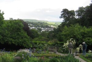
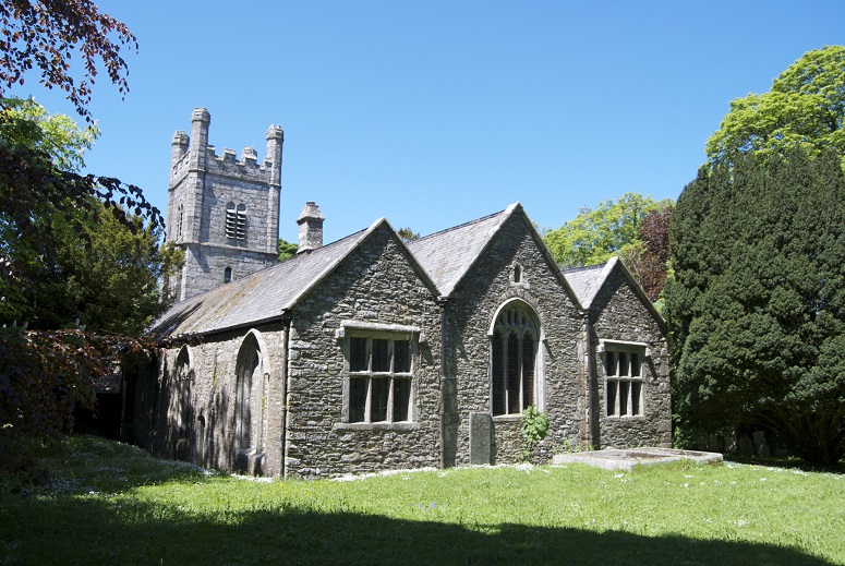
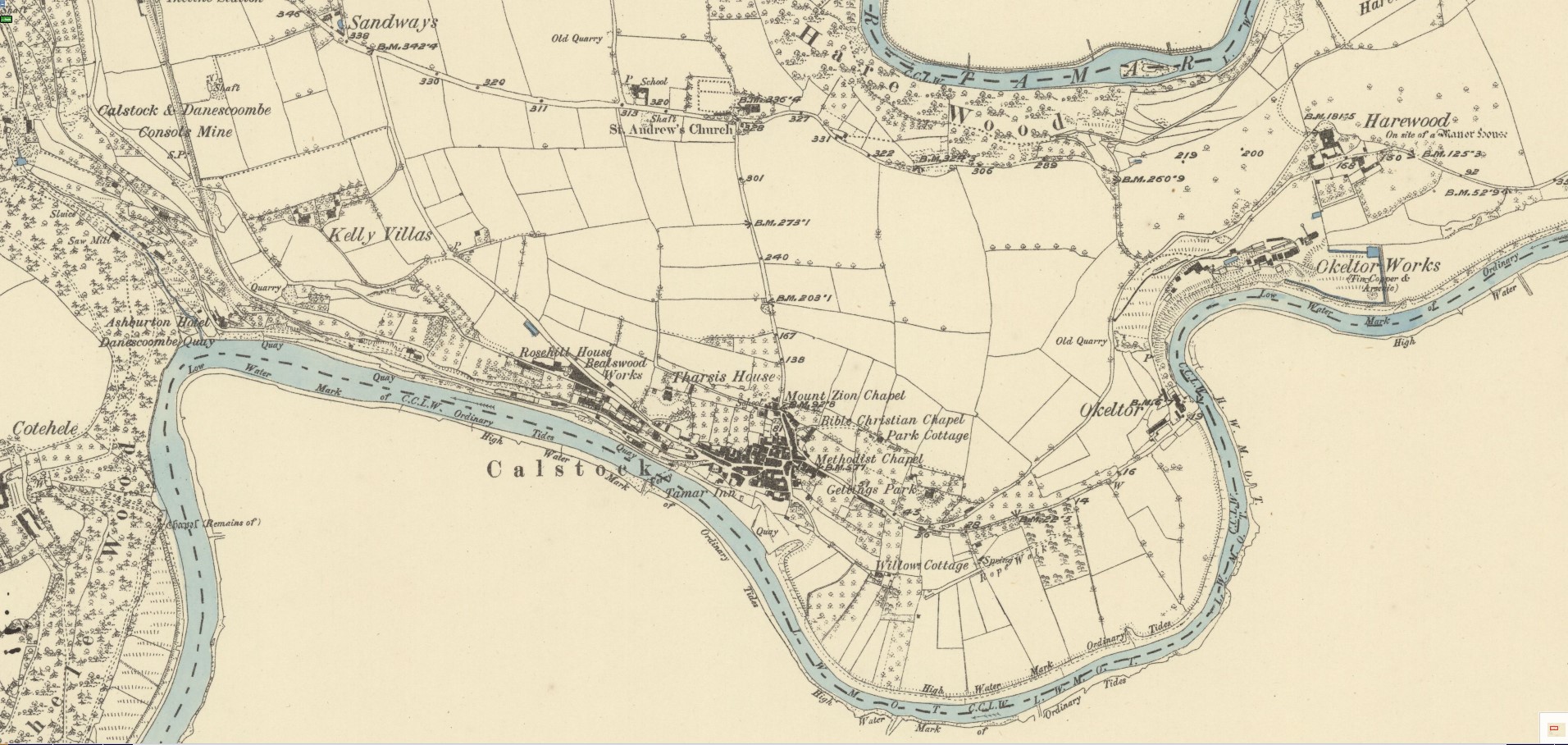
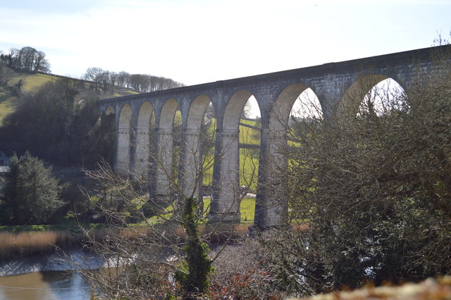
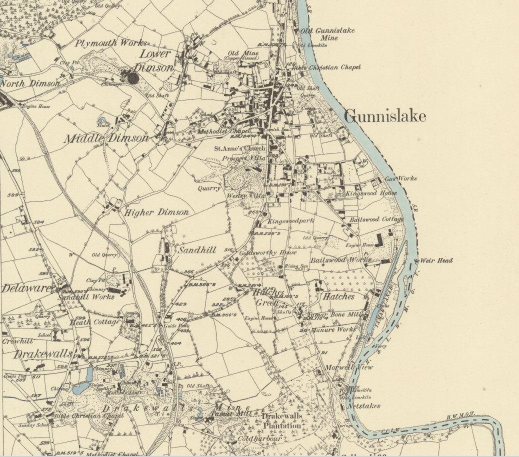
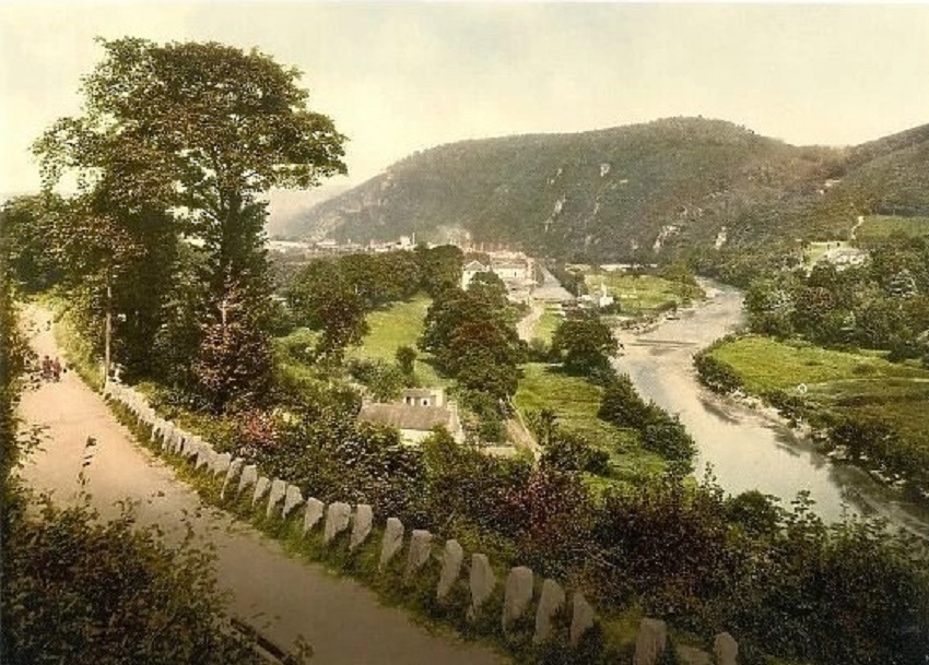
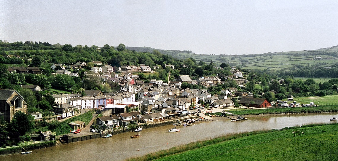
The village of Calstock lies on the River Tamar giving its name to the whole parish. Besides Calstock the other notable settlement is the village of Gunnislake. The population of the parish is now about 6,500 people mostly located in these two settlements, but also scattered throughout are the villages of St Ann’s Chapel and the now much grown original medieval hamlets of Harrowbarrow and Metherell. Calstock is ancient enough to have been mentioned in Domesday in 1086. There was a church here from at least the 13th century but St Andrews Church which now stands on that site has some of the earliest pillars and arch remnants, from the fifteenth century. The church lies not within the settlement of Calstock but perched on a hill to the north and it’s reached along country lanes and surrounded by trees with extensive burial grounds. Perhaps this suggests that the site of the historic Calstock community originated as a church town around the church not where the current village is now located. The riverside village location no doubt developed as the need for quays to load and unload vessels carrying minerals and other local produce along the Tamar evolved. The church lies within the site of a Roman fort discovered accidently by archaeologists in 2007. In 2023 Channel 4’s ‘The Great British Dig’ visited the site to investigate further. This television programme can be found on demand via the internet.
As always click the images for larger view
Just north of Gunnislake is a hill known as Hingston Down. Historians hold that this site was the place that the Battle of Hingston Down look place in 838. Here it was the Cornish army with their Viking allies were defeated by King Ecgbert of Wessex. Later this became an important area for tin mining up to the late medieval period. By about 1594 the topographer John Norden observed and commented ‘The Countrie people haue a Byeworde, Hengston down welle wrowghte Is worth London town deare bowghte. It hath bene verie riche in tynn-workes, now nothing so plentifull ...’ Just a few years later Carew in his Survey of Cornwall confirmed this, writing; ‘that gainful plenty is now fallen to a scant-saving scarcity’. However not all was lost and following the industrialisation of Cornish mining with development of steam powered pumps the 19th century there were several shafts dug in this area. There was the older Prince of Wales Mine and the Hingston Down Consols Mine which ran between 1843 and 1925 produced copper, tin, tungsten and arsenic employing some 225 men in the 1860’s.
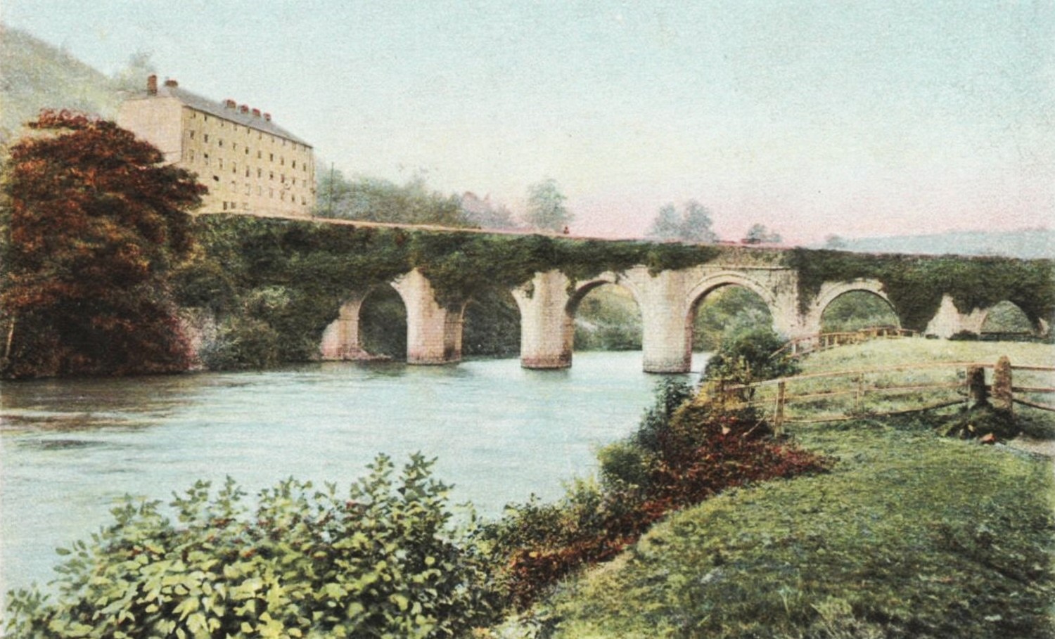
Just north of Gunnislake is the historic Newbridge built in 1520 on the instruction of Sir Piers Edgcumbe. This would be the lowest bridge on the River Tamar until the 19th century and would be one of the main access routes into Cornwall. The fact that this bridge is still in use helps testify to its importance. During the English Civil War there was a battle held at the bridge between the Royal soldiers and the Parliamentarian forces. The Battle of Gunnislake New Bridge took place on 20th July 1620 with the defence of Cornwall against the Parliamentarians led by Richard Grenville, brother of the famous Sir Bevill Grenville who had perished the previous year. Although the Royalist Cornish forces lost most men, they did prevent the Parliamentary forces under Robert Devereux, 3rd Earl of Essex from crossing into Cornwall. Although Devereux did eventually enter Cornwall across Horsebridge his army was defeated at the Battle of Lostwithiel. This remains a busy Tamar crossing and more recently a continuing battle of Newbridge exists between the historic bridge and motor vehicles far less suited to crossing it than the horses and carts of the 16th century.
South of Gunnislake was one of the few canals built in Cornwall. Not a great success this did not run its fully planned course which would have taken it from the Bude Canal at Tamerton Bridge down the River Tamar to Morwellham Quay. In fact, the man-made part of the canal ran for only 500 yards creating an arm off the Tamar into Gunnislake. The plan for a 20-mile waterway was to transport primarily lime and sea sand for agricultural use. The Act of Parliament passed in 1796 also mentioned the transportation was to be used for coals, timber, stone, slate and corn. Although construction ceased in 1808 this short man-made canal operated for nearly 120 years until the River Tamar ceased to be navigable this far inland around 1929 and operated far longer than any other Cornish canal.
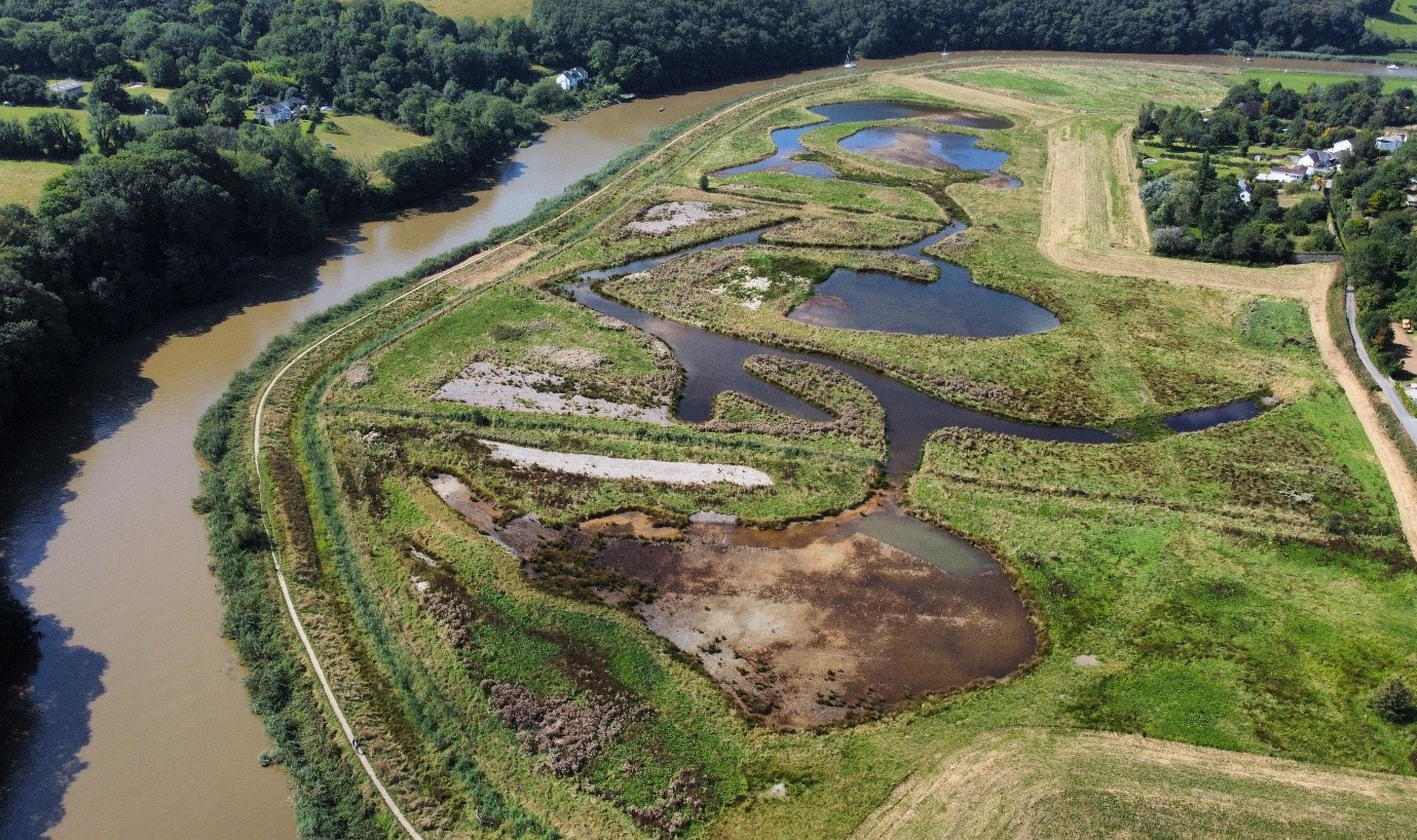
Wonderful to see that an area covering 27 acres has been created as a wetland habitat. This investment is not just supporting wildlife, but also protecting the local community against flooding. The sediment trapped within the wetland area will help build a natural defence during this period of climate change and altering weather conditions. A new footbridge has been built to allow the earlier footpath to continue being used and besides the additional economic benefits of the Tamara Way through tourism to Calstock there is increased interests from bird watchers. The new social media group ‘Calstock Wetlands Birdwatchers Group’ is reporting sightings of many species of bird new to this area.
As attitudes change and there is greater interest in tree planting hopefully the Calstock region will return to its 16th century roots, where this area was well-known for its apple orchards and soft fruit growing. Cotehele has maintained its own orchards and has a wealth of varieties grown there. References were made by writers and in other documents about orchards and the sale of cider during the 17th century. Later market gardening became an important source of income for the area, chiefly relating to soft fruits and especially cherries. This type of agriculture was encouraged by wealthy landowners who rented out land as they could get higher rents per acre for market gardens rather than arable farming. In this they encouraged good maintenance of the land to ensure that rents could be paid, and reletting would be quick and easy. In 1814 the Cornwall edition of the Lyson brothers Magna Britannia noted that Calstock and Stoke Climsland parishes ‘abound in cherry orchards’. This trade in turn added to the 19th century growth in mining ensured a busy river trade down to Devonport and the growing town of Plymouth. Later of course the railways would ensure that fruit and other produce from Calstock parish would reach other southern English towns and cities including London. Later strawberries and raspberries would become equally important as cherries and a more reliable annual crop. As well as apples, pears were also grown, and the Cornish historian and author Joseph Polsue recorded that during the 1870’s Calstock had 400 acres of orchards and gardens and the adjacent parish Landulph 503. Although these orchards and gardens for flower production continued apace after World War One the period following the Second World War was a disaster for orchards. With tree crops much reduced farmers were offered £100 per acre to destroy their orchards. Likewise, there was a drastic reduction in soft fruit production as young people moved away from working the land. With the emergence of a strong cider production industry in Cornwall hopefully there will be a growth in orchards to meet demand. The writer recently learned that a certain well-known Cornish cider brand is even having to import apples from Devon.
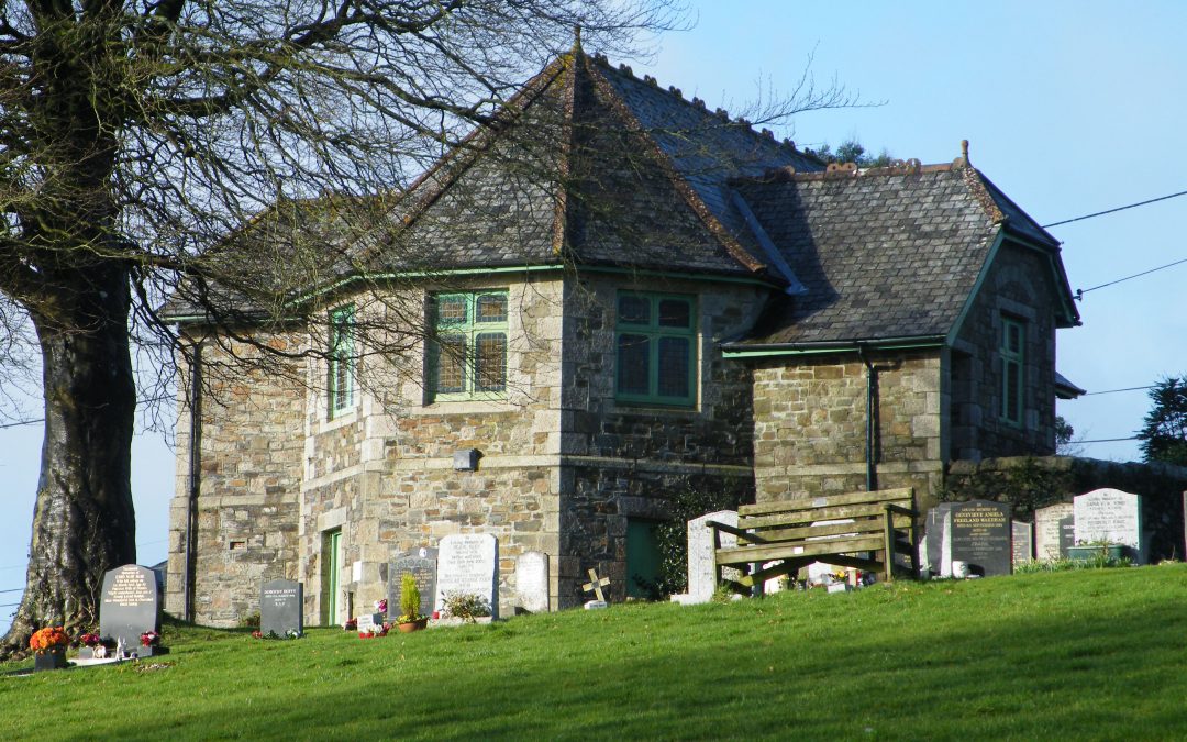
Looking at newsletters and social media posts there is a definite feeling of community within the parish of Calstock. Perhaps this is helped by the area being part of a recognised Area of Outstanding Natural Beauty and a World Heritage Site, with funding from multiple sources allowing a proactive community to engage in many environmental projects. I’m always so happy to hear that a village or parish has an archive with volunteers who work hard at preserving their local Cornish history and heritage. Calstock has its own Parish Archive created in 1985 and after outgrowing the shared accommodation at the village hall a move to the Tamar Valley Visitor Centre followed shortly afterwards with the help of the Calstock Parish Council to the repurposed Albaston Cemetery Chapel. Fortunately, there are a good number of parish, village and town councils throughout Cornwall who do realise the importance of local history and heritage and proactively support local volunteer groups.
Like many places in Cornwall Calstock is seeing the growth of second houses and Airbnb’s. This area which is in an Area of Outstanding Natural Beauty and part of a World Heritage Site is in danger of being ruined as much of Cornwall further west has been. One can only hope that regulation and setting higher council taxes will prevent Calstock’s ruination and that other parts of Cornwall can gradually claw back and preserve their own local Cornish communities.
![[187] Ertach Kernow Heritage Column - 24th January 2024 - Duloe Stone Circle & Cornish memory game Ertach Kernow Heritage Column - 24th January 2024 - Duloe Stone Circle & Cornish memory game](https://www.cornwallheritage.com/wp-content/uploads/2024/01/187-Ertach-Kernow-Heritage-Column-24th-January-2024-Duloe-Stone-Circle-Cornish-memory-game-286x300.jpg)