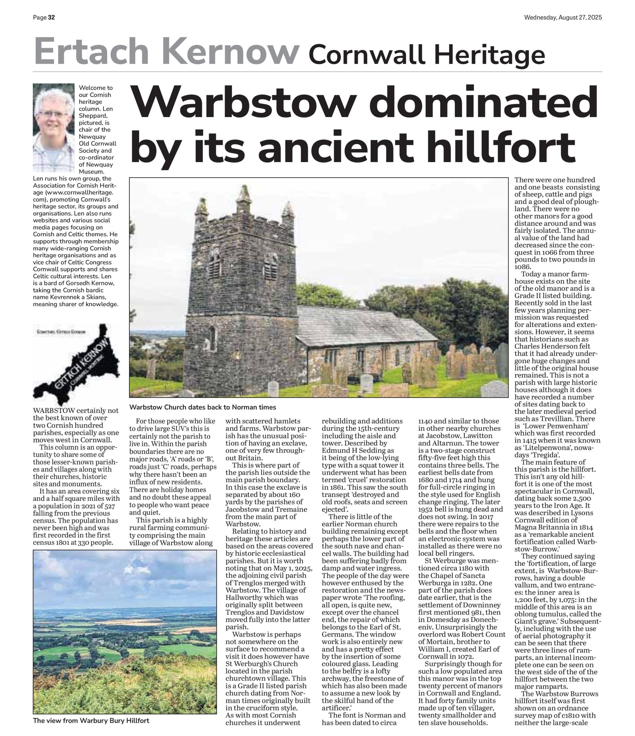
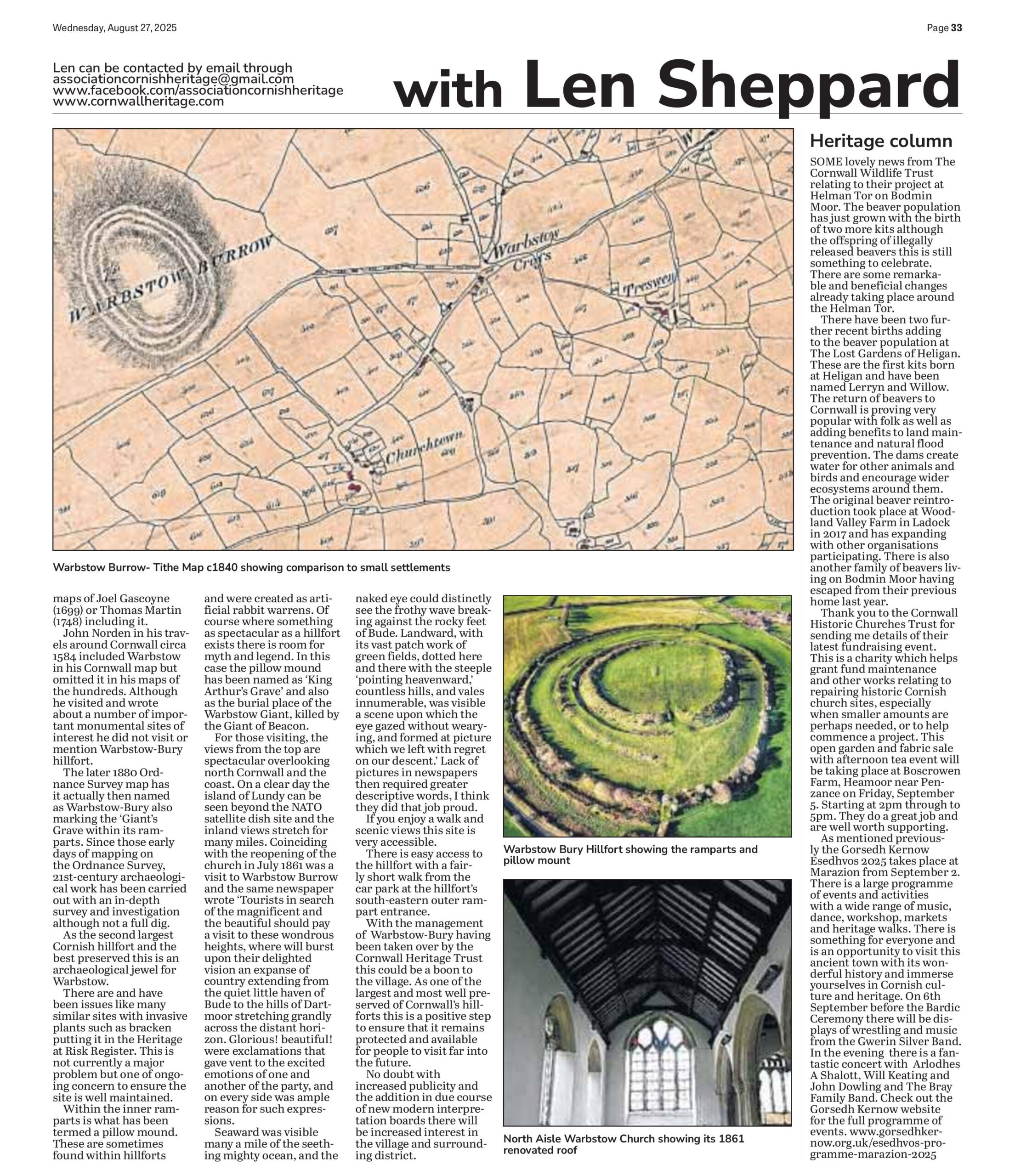
Ertach Kernow - Warbstow dominated by its ancient hillfort
Warbstow certainly not the best known of over two Cornish hundred parishes, especially as one moves west in Cornwall. This column is an opportunity to share some of those lesser-known parishes and villages along with their churches, historic sites and monuments. It has an area covering six and a half square miles with a population in 2021 of 527 falling from the previous census. The population has never been high and was first recorded in the first census 1801 at 330 people. For those people who like to drive large SUV’s this is certainly not the parish to live in. Within the parish boundaries there are no major roads, ‘A’ roads or ‘B’, roads just ‘C’ roads, perhaps why there hasn’t been an influx of new residents. There are holiday homes and no doubt these appeal to people who want peace and quiet.
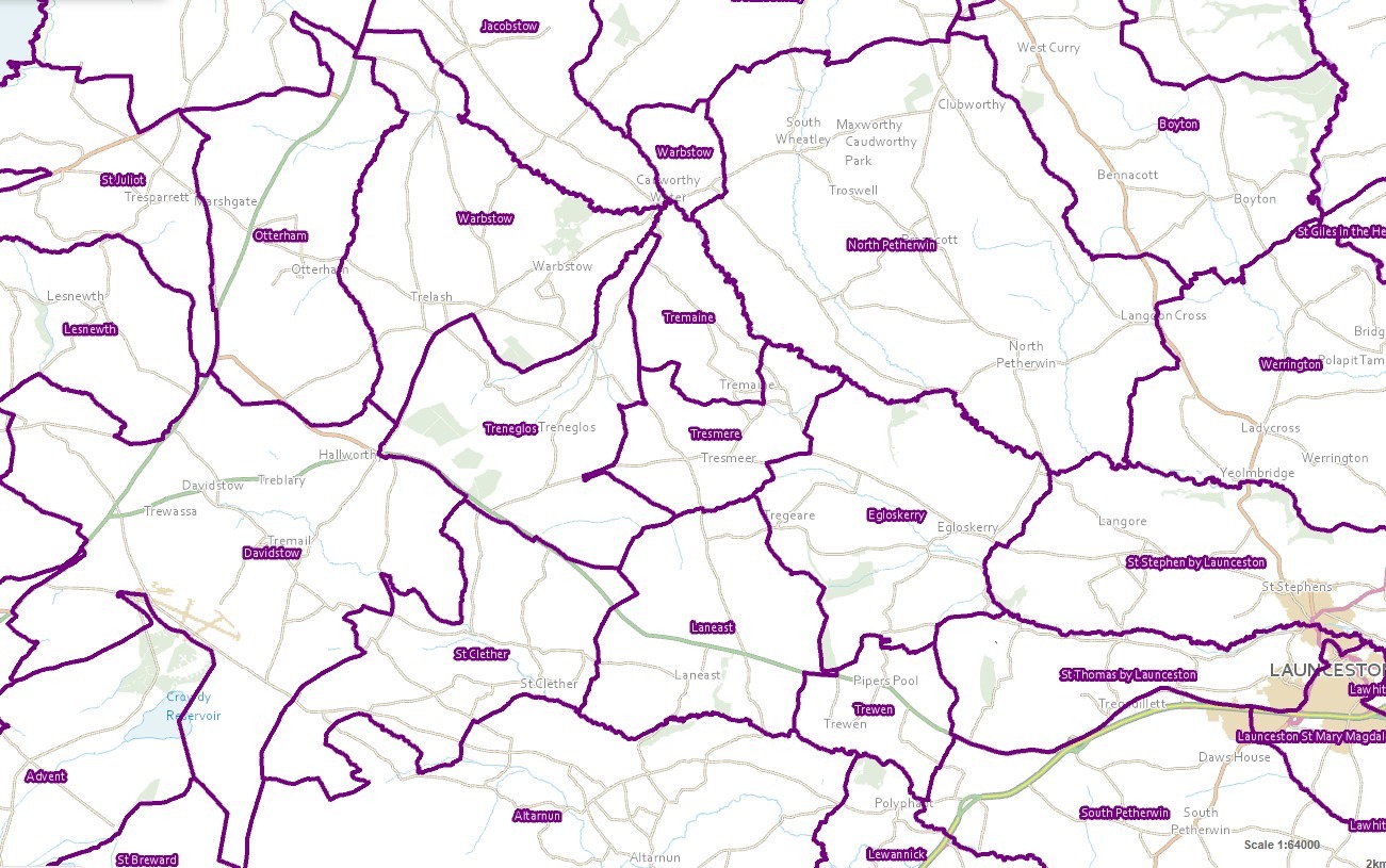
This parish is a highly rural farming community comprising the main village of Warbstow along with scattered hamlets and farms. Warbstow parish has the unusual position of having an exclave, one of very few throughout Britain. This is where part of the parish lies outside the main parish boundary. In this case the exclave is separated by about 160 yards by the parishes of Jacobstow and Tremaine from the main part of Warbstow. Relating to history and heritage these articles are based on the areas covered by historic ecclesiastical parishes. But it is worth noting that on May 1st 2025 the adjoining civil parish of Trenglos merged with Warbstow. The village of Hallworthy which was originally split between Trenglos and Davidstow moved fully into the latter parish.
Thank you for reading the online version of the Ertach Kernow weekly articles. These take some 12 hours each week to research, write and then upload to the website, and is unpaid. It would be most appreciated if you would take just a couple of minutes to complete the online survey marking five years of writing these weekly articles. Many thanks.
Click the link for survey: Ertach Kernow - Short Survey Link
As always click the images for larger view
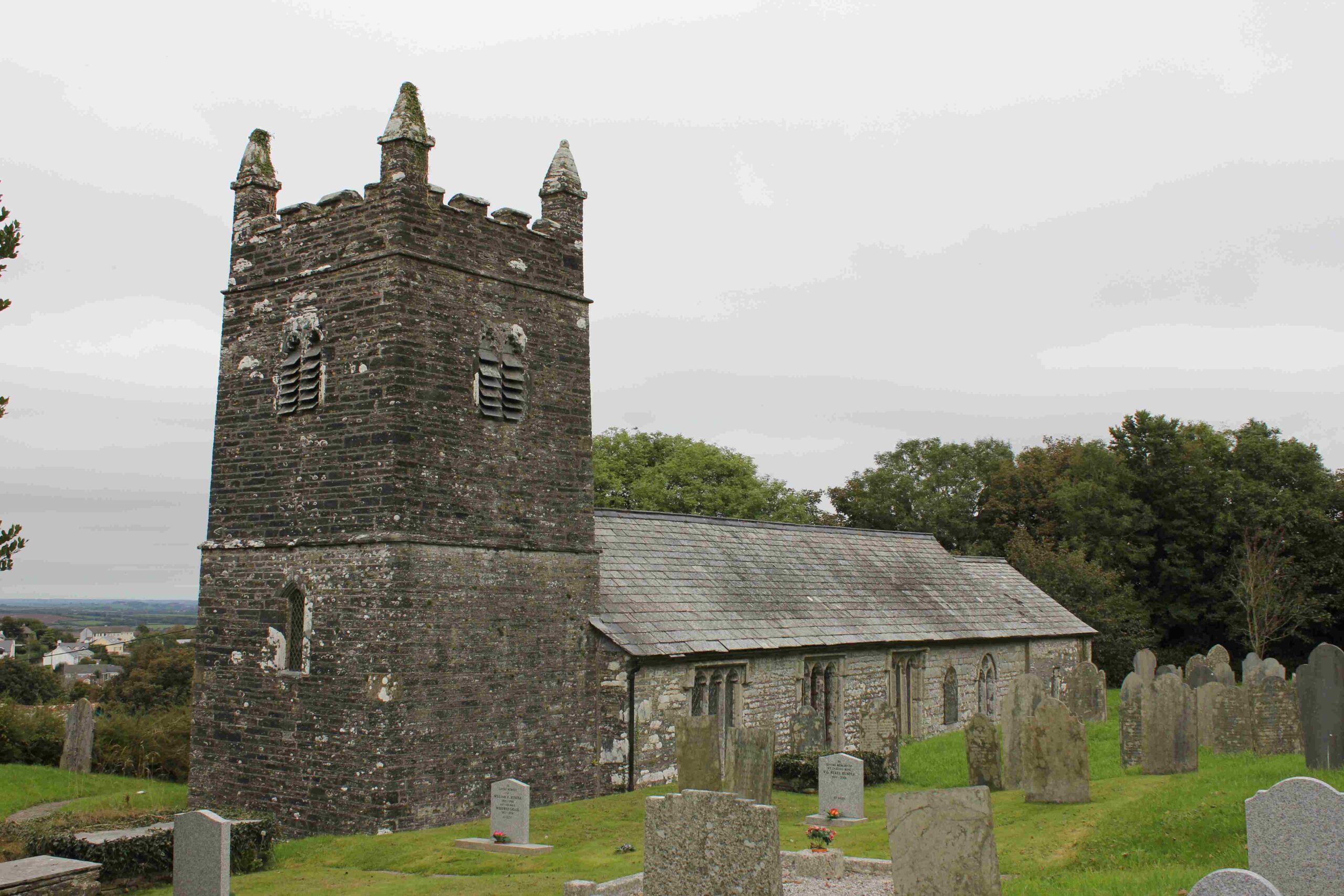
Warbstow is perhaps not somewhere on the surface to recommend a visit it does however have St Werburgh's Church located in the parish churchtown village. This is a Grade II* listed parish church dating from Norman times originally built in the cruciform style. As with most Cornish churches it underwent rebuilding and additions during the 15th century including the aisle and tower. Described by Edmund H Sedding as it being of the low-lying type with a squat tower it underwent what has been termed ‘cruel’ restoration in 1861. This saw the south transept ‘destroyed and old roofs, seats and screen ejected’. There is little of the earlier Norman church building remaining except perhaps the lower part of the south nave and chancel walls. The building had been suffering badly from damp and water ingress. The people of the day were however enthused by the restoration and the newspaper wrote ‘The roofing, all open, is quite new, except over the chancel end, the repair of which belongs to the Earl of St. Germans. The window work is also entirely new and has a pretty effect by the insertion of some coloured glass. Leading to the belfry is a lofty archway, the freestone of which has also been made to assume a new look by the skilful hand of the artificer.’
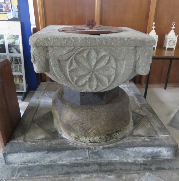
The font is Norman and has been dated to circa 1140 and similar to those in other nearby churches at Jacobstow, Lawitton and Altarnun. The tower is a two-stage construct fifty-five feet high this contains three bells. The earliest bells date from 1680 and 1714 and hung for full-circle ringing in the style used for English change ringing. The later 1952 bell is hung dead and does not swing. In 2017 there were repairs to the bells and the floor when an electronic system was installed as there were no local bell ringers.
St Werburge was mentioned circa 1180 with the Chapel of Sancta Werburga in 1282. One part of the parish does date earlier, that is the settlement of Downinney first mentioned 981, then in Domesday as Donecheniv. Unsurprisingly the overlord was Robert Count of Mortain, brother to William I, created Earl of Cornwall in 1072. Surprisingly though for such a low populated area this manor was in the top twenty percent of manors in Cornwall and England. It had forty family units made up of ten villager, twenty smallholder and ten slave households. There were one hundred and one beasts consisting of sheep, cattle and pigs and a good deal of ploughland. There were no other manors for a good distance around and was fairly isolated. The annual value of the land had decreased since the conquest in 1066 from three pounds to two pounds in 1086.
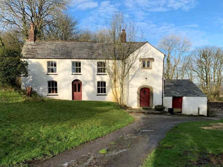
Today a manor farmhouse exists on the site of the old manor and is a Grade II listed building. Recently sold in the last few years planning permission was requested for alterations and extensions. However, it seems that historians such as Charles Henderson felt that it had already undergone huge changes and little of the original house remained. This is not a parish with large historic houses although it does have recorded a number of sites dating back to the later medieval period such as Trevillian. There is ‘Lower Penwenham’ which was first recorded in 1415 when it was known as ‘Litelpenwona’, nowadays 'Tregida'.
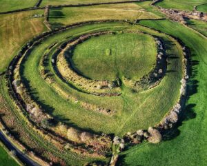
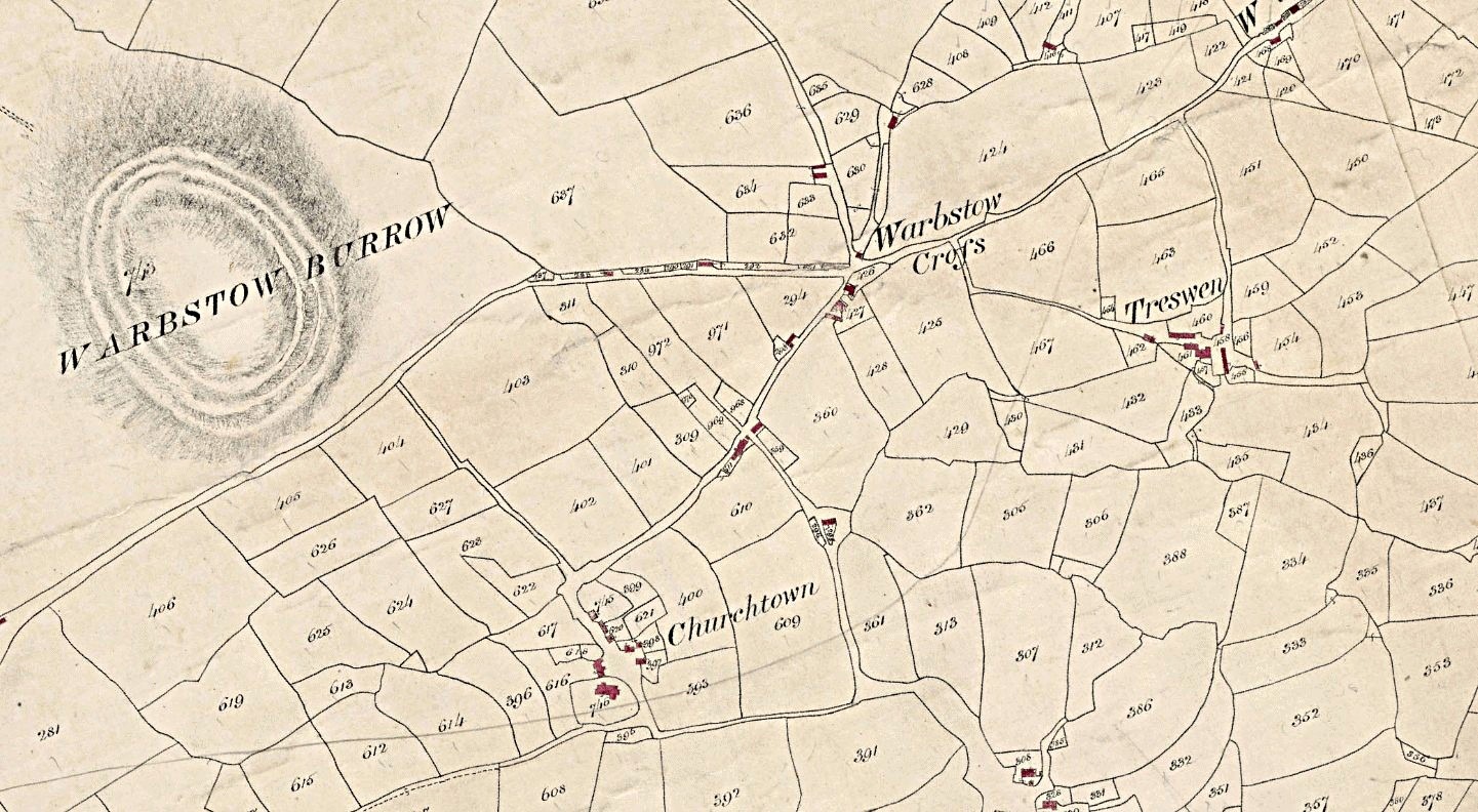
The main feature of this parish is the hillfort. This isn’t any old hillfort it is one of the most spectacular in Cornwall, dating back some 2,500 years to the Iron Age. It was described in Lysons Cornwall edition of Magna Britannia in 1814 as a ‘remarkable ancient fortification called Warbstow-Burrow.’ They continued saying the ‘fortification, of large extent, is Warbstow-Burrows, having a double vallum, and two entrances: the inner area is 1,200 feet, by 1,075: in the middle of this area is an oblong tumulus, called the Giant's grave.’ Subsequently, including with the use of aerial photography it can be seen that there were three lines of ramparts, an internal incomplete one can be seen on the west side of the of the hillfort between the two major ramparts.
The Warbstow Burrows hillfort itself was first shown on an ordnance survey map of c1810 with neither the large-scale maps of Joel Gascoyne (1699) or Thomas Martin (1748) including it. John Norden in his travels around Cornwall circa 1584 included Warbstow in his Cornwall map but omitted it in his maps of the hundreds. Although he visited and wrote about a number of important monumental sites of interest he did not visit or mention Warbstow-Bury hillfort. The later 1880 Ordnance Survey map has it actually then named as Warbstow-Bury also marking the ‘Giant’s Grave within its ramparts. Since those early days of mapping on the Ordnance Survey, 21st century archaeological work has been carried out with an in-depth survey and investigation although not a full dig. As the second largest Cornish hillfort and the best preserved this is an archaeological jewel for Warbstow. There are and have been issues like many similar sites with invasive plants such as bracken putting it in the Heritage at Risk Register. This is not currently a major problem but one of ongoing concern to ensure the site is well maintained.
Within the inner ramparts is what has been termed a pillow mound. These are sometimes found within hillforts and were created as artificial rabbit warrens. Of course where something as spectacular as a hillfort exists there is room for myth and legend. In this case the pillow mound has been named as ‘King Arthur’s Grave’ and also as the burial place of the Warbstow Giant, killed by the Giant of Beacon.
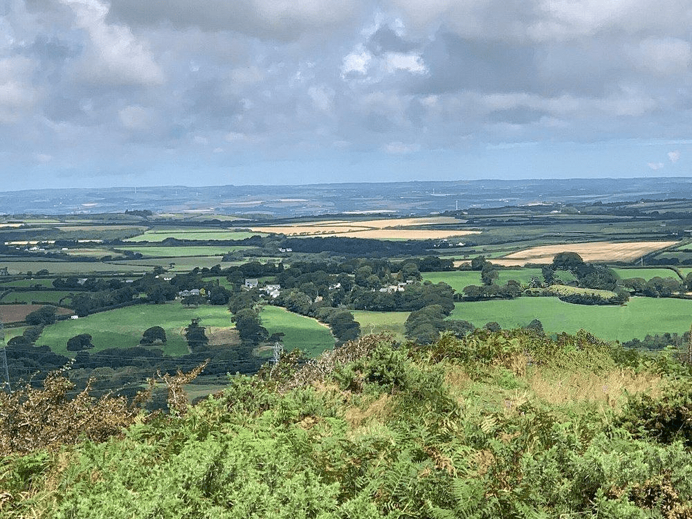
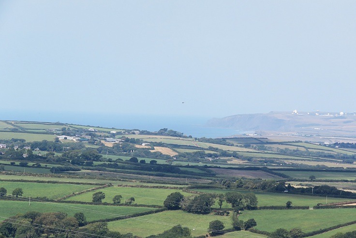
For those visiting, the views from the top are spectacular overlooking north Cornwall and the coast. On a clear day the island of Lundy can be seen beyond the NATO satellite dish site and the inland views stretch for many miles. Coinciding with the reopening of the church in July 1861 was a visit to Warbstow Burrow and the same newspaper wrote ‘Tourists in search of the magnificent and the beautiful should pay a visit to these wondrous heights, where will burst upon their delighted vision an expanse of country extending from the quiet little haven of Bude to the hills of Dartmoor stretching grandly across the distant horizon. Glorious! beautiful! were exclamations that gave vent to the excited emotions of one and another of the party, and on every side was ample reason for such expressions. Seaward was visible many a mile of the seething mighty ocean, and the naked eye could distinctly see the frothy wave breaking against the rocky feet of Bude. Landward, with its vast patch work of green fields, dotted here and there with the steeple ‘pointing heavenward,’ countless hills, and vales innumerable, was visible a scene upon which the eye gazed without wearying, and formed at picture which we left with regret on our descent.’ Lack of pictures in newspapers then required greater descriptive words, I think they did that job proud.
With the management of Warbstow-Bury having been taken over by the Cornwall Heritage Trust this could be a boon to the village. As one of the largest and most well preserved of Cornwall’s hillforts this is a positive step to ensure that it remains protected and available for people to visit far into the future. No doubt with increased publicity and the addition in due course of new modern interpretation boards there will be increased interest in the village and surrounding district.
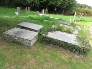
I thought I’d better take my own advice to visit. So during the bank holiday weekend when Newquay was infested with tourists off we went. How peaceful with just one car in the small carpark to the foot of the hillfort. The weather was fantastic and yes you could see for miles over the countryside and to the coast. We visited the small church and had a wander inside, it was clean and well maintained, yet again nobody in sight. The churchyard had a number of chest tombs grouped together, perhaps those belonging to an extended family.
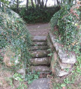
What was interesting to the rear entrance of the churchyard through the Cornish stone hedge was a Cornish grid stile. Rural areas have many differing access points to fields other than a gate to restrict livestock. Visitors to say Bodmin Moor will have crossed a number of metal cattle grids in the roads keeping freely roaming livestock within the moor. There are traditional stiles that people need to climb over, or what have become known as kissing gates allowing one person through at a time. The Cornish grid stile at Warbstow Church is obviously historic and is in effect a cattle grid made out of stone.
A video showing Warbstow Hillfort and surrounding countryside is being produced and will be available shortly

