Ertach Kernow - Early Cornish maps and historic texts
Cornish maps from earlier periods are interesting, not just because they are Cornish or attractive but also for the information they can tell us about the past. The earliest maps of Cornwall as part of Great Britain are pretty rudimentary, so much so you’d often be hard pressed to know what it exactly was.
As always click the images for larger view
Although Cornwall was known and mentioned by Herodotus, who referred to Cornwall as the Cassiterides or ‘Tin Islands’ around BCE445 there was no map. Later in BCE325 it was Pytheas of Massalia who really brought the existence of Great Britain into the known world. Prior to his circumnavigation around the coast of Britain, acknowledging it was of a somewhat triangular shape, the Anglo-Celtic Isles were not noted on any map. The writings of Pytheas ‘Peri tou Okeanou’, translated to ‘On the Ocean’, were tragically destroyed through the destruction of the great Library of Alexandria along with any map he may have produced. Fortunately, his text has been preserved through eighteen other writers who included extracts in their own works. Perhaps one of the best-known writers from the ancient world was Pliny the Elder who died in CE79. Massalia was a major trading centre for tin throughout the Mediterranean. Although the Cassiterides were mentioned by Herodotus earlier, the actual origins of tin were unknown as ‘middlemen’ transported it from the source. it seems Pytheas was engaged to seek out the actual source of the tin and make contact with the miners.
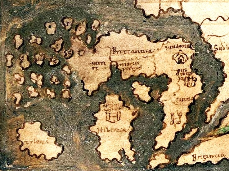
Possibly the first map which includes Cornwall is at the British Museum, part of a collection possibly copied at Canterbury in the mid-11th century. It includes the Anglo-Celtic Isles, totally misshapen but identifiable, in the bottom left of the ‘Cotton World Map’ Cornwall is shown as very elongated with no other information.
Matthew Paris is a name little known amongst non-historians. Born around 1200 he became a close confidant of King Henry III and more importantly for Cornwall, Richard Earl of Cornwall. He had become a Benedictine monk at St Albans Abbey, recognised as England’s premier monastery as a young man. Matthew likely came from a background that might have been relatively affluent. His language skills were versatile and he was able to converse in Latin, Anglo- Norman French used by the court and vernacular Middle English used by ordinary people. Throughout his adult life Matthew chronicled many events in great detail, with information gleaned from travellers visiting the Abbey, including many of the good and great of the time. His works certainly tell us a lot about Richard Earl of Cornwall, his wealth and his life. It can be presumed that much of this came directly from Richard himself.
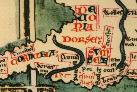
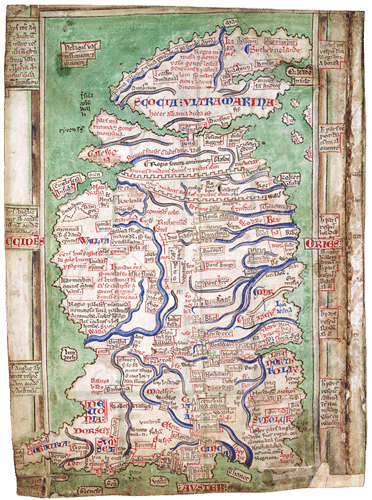
Toward the end of his life Matthew, who besides being a scribe was also a skilled artist for the time. He created a series of maps to accompany his various copies of his history of England. Perhaps the most famous is that known as the Claudius map, dated to about 1250. Claudius is a complex map with lots of information including regions, cities, monasteries, and castles. It is not geographically correct, certainly relating to the English counties bordering Cornwall. The Cornish map area within what might be considered to be the River Exe is labelled Cornubia. This is a historic name relating to the tribal territory of the Cornovii, part of the original Roman administrative region of Dumnonia. Tintagel Castle is noted on the map, likely included through his connection with its builder, Richard Earl of Cornwall. Unfortunately, West Penwith seems to have not survived on the map and the relating remaining text cannot be translated. Strangely, what can be presumed as the River Exe seems to lie within Cornubia, along with Dartmouth and Exeter. Devon, besides losing Dartmouth and Exeter joined Dorset and Somerset in becoming rather muddled on the map. Amusingly one named translation is to ‘Land’s End’ which has been located east of the River Exe in Somerset. It seems Matthew and his contemporaries at St Albans Abbey lacked certain geographical knowledge of Cornwall and southwest England. Although Matthew had travelled throughout England and also abroad it was unusual for monks to do so, hence this aberration. The map of Britain as whole is a valuable historical asset along with Paris’ chronology of that period of medieval history
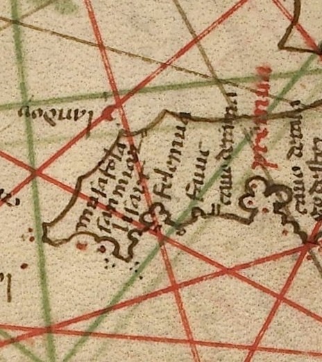
Genoa became an important republic city state from the 11th century with wide maritime interests. It’s not surprising that as a mercantile power they would take interest in mapping Britain including Cornwall. The Genoese cartographer Pietro Vesconte produced a number of maps between 1310 and 1330, later moving to Venice then becoming a Mediterranean maritime power. The creation of large scale mappa mundi, medieval maps of the world as it was known then, were being replaced by Portolan charts. These emerging charts created during the late 13th and early 14th centuries were important navigational aids for Mediterranean sailors. They were much more detailed and included information such as representation of ports, headlands, and hazards like reefs and shoals, drawn to approximate scale. Besides the Mediterranean, maps of Cornwall and the southern ports of Cornwall were included in some of Pietro Vesconte’s charts. Mousehole, St Michael's Mount, Lizard, Falmouth and Fowey were mentioned on a map dated c1331, although nothing on the north Cornish coast. This perhaps reflects that the southern coastline of Cornwall was much more accessible and closer to trading opportunities in France. Also, the dangers to vessels rounding Land’s End would remain a factor well into the late 19th century.
A later portolan sailing chart of Cornwall dated 1466 drawn by Grazioso Benincasa of Ancona, Italy shows additional information of Cornish ports. These include Mousehole, Falmouth, Fowey as well as bays on the north coast perhaps an indication of places to port at St Ives and into the Camel Estuary for Padstow and Wadebridge. These Mediterranean created maps would continue to develop with that of 1510 by Visconte Maggiolo of Genoa showing further north Cornwall coastal settlements.
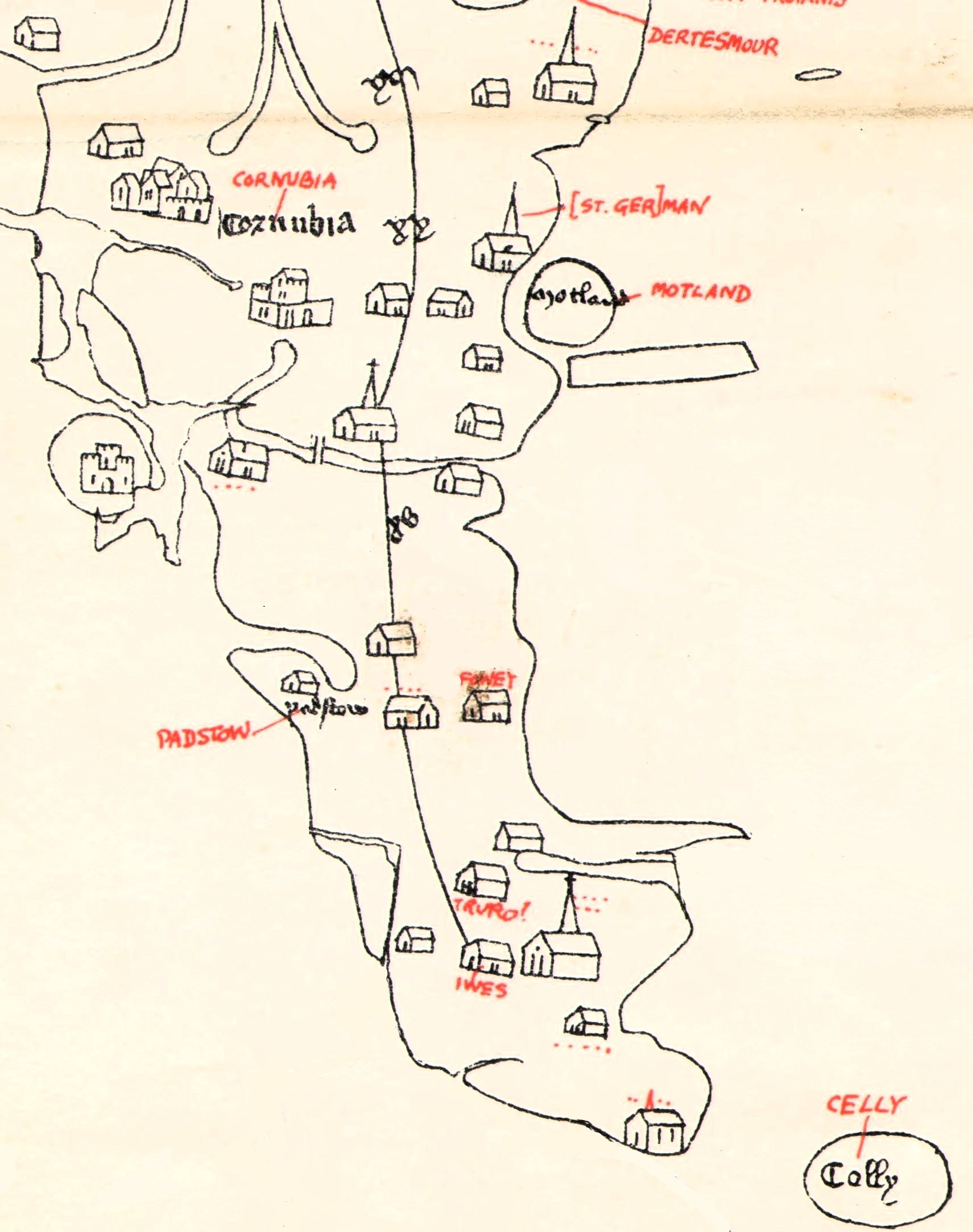
The Gough Map is one of the most interesting maps of the medieval period. Also known as the Bodleian Map it has been held there since its donation by Richard Gough to the Bodleian Library in 1809. Academics have various dates when they considered to have been created, but likely to around 1355. The maps area relating to Cornwall is rather difficult to interpret due to age damage. Usefully, Ordnance Survey produced a far more readable hand drawn map including the settlements noted on the original map. This includes places already mentioned in history such as Fowey, Padstow and Truro along with various other unnamed settlements. Who conceived and drew the Gough map is unknow but may have existed from an even earlier period and updated over a number of years. The Cornish map area is again referred to as Cornubia and in the Gough Map Devon is in its correct place.
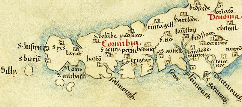
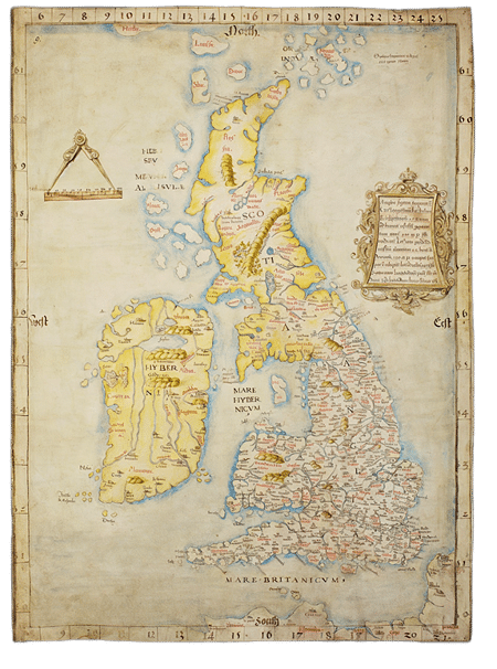
As Britain moved into the Tudor period maps became more accurate and also contained far greater information than earlier maps. Angliae Figura, also known as the map of the British Isles was created during the reign of Henry VIII between 1534 and 1536 and presented to Henry in 1537 by the Bishop of Rochester. The number of place names at 633 is far more than any previous map of Britain. For Cornwall there are more towns and villages included such as St Buryan, St Columb, St Michael’s Mount and St Neot. These had greater importance during earlier times as religious centres, or as ports in the case of Lelant, St Ives and Padstow. There is far greater emphasis on the river estuaries at Falmouth, Fowey and the Tamar than previously shown. Tintagel, not a particularly important place by Tudor times remains named, perhaps through its Duchy of Cornwall and Arthurian connections. St Just and St Austell make an appearance although still relatively small. Eagle eyed Cornish folk may notice however that St Germans has been incorrectly located in Devon between Plymouth and Dartmouth. This map and the earlier Gough Map are thought to have been a continuation of a common source map of the late 13th century but updated with additional information.
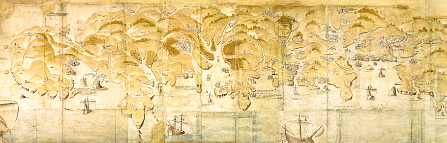
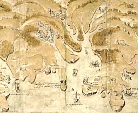
The defence of the realm was another opportunity to create maps especially relating to coastal areas. Between 1539-1540 a ten-foot map was produced covering from Exeter to Land’s End. Thomas Cromwell chancellor to Henry VIII ordered this to be produced to show where invaders might possibly land. This was part of the planning for what would become the Henrician device fortifications which aimed to protect the country against France and the Holy Roman Empire. A range of blockhouses, earthworks and castles were constructed around the coast of England, Wales and Cornwall, including at the mouth of Carrick Roads. For Cornwall this was seen as an area of major risk due to Carrick Roads being an extensive natural harbour for shipping with river inroads far into the Cornish interior. At the mouth of the estuary Pendennis and St Mawes castles were constructed between 1540 and 1542, these were two of the largest Henrician fortifications,
Over some five hundred years to the Tudor period maps of Britain, including Cornwall, had evolved substantially. Progression from the earliest medieval mappa mundi, through those created as navigation aids and later for strategic planning. The reign of Elizabeth would see maps produced that showed even greater information about settlements inland. People such as John Leland had already visited and written about many places in Cornwall. John Norden would take this further with his maps, descriptions and drawing of places, monuments and sites of interest throughout Cornwall.
Heritage Column
Heritage in the News online links: