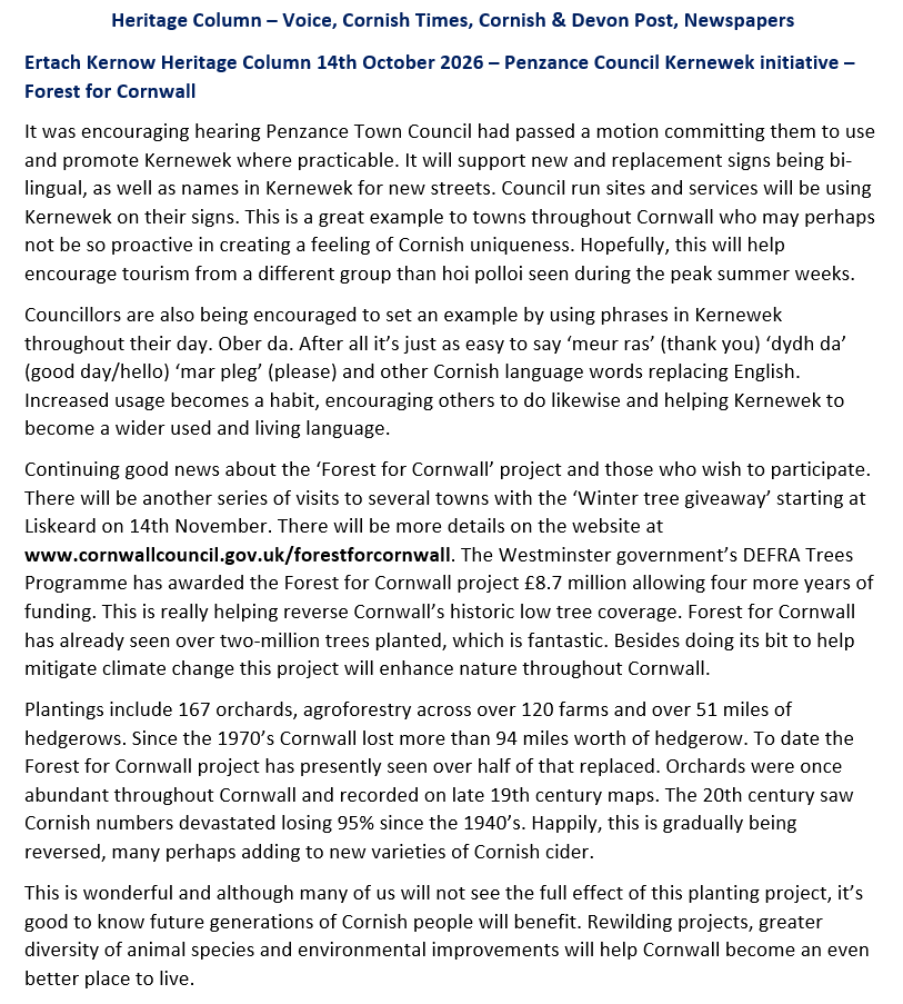
Ertach Kernow - Mount’s Bay, historical beautiful and dangerous
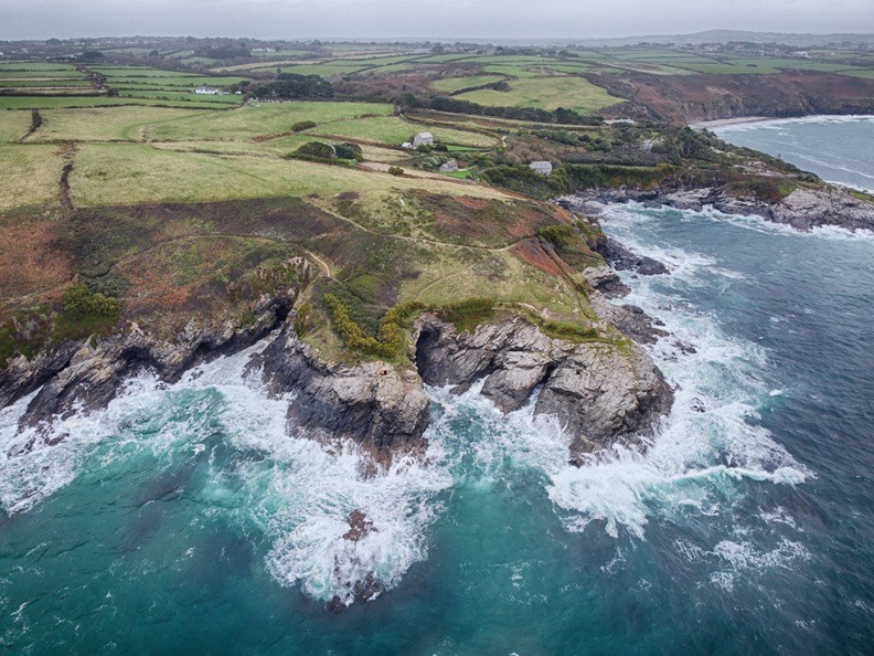
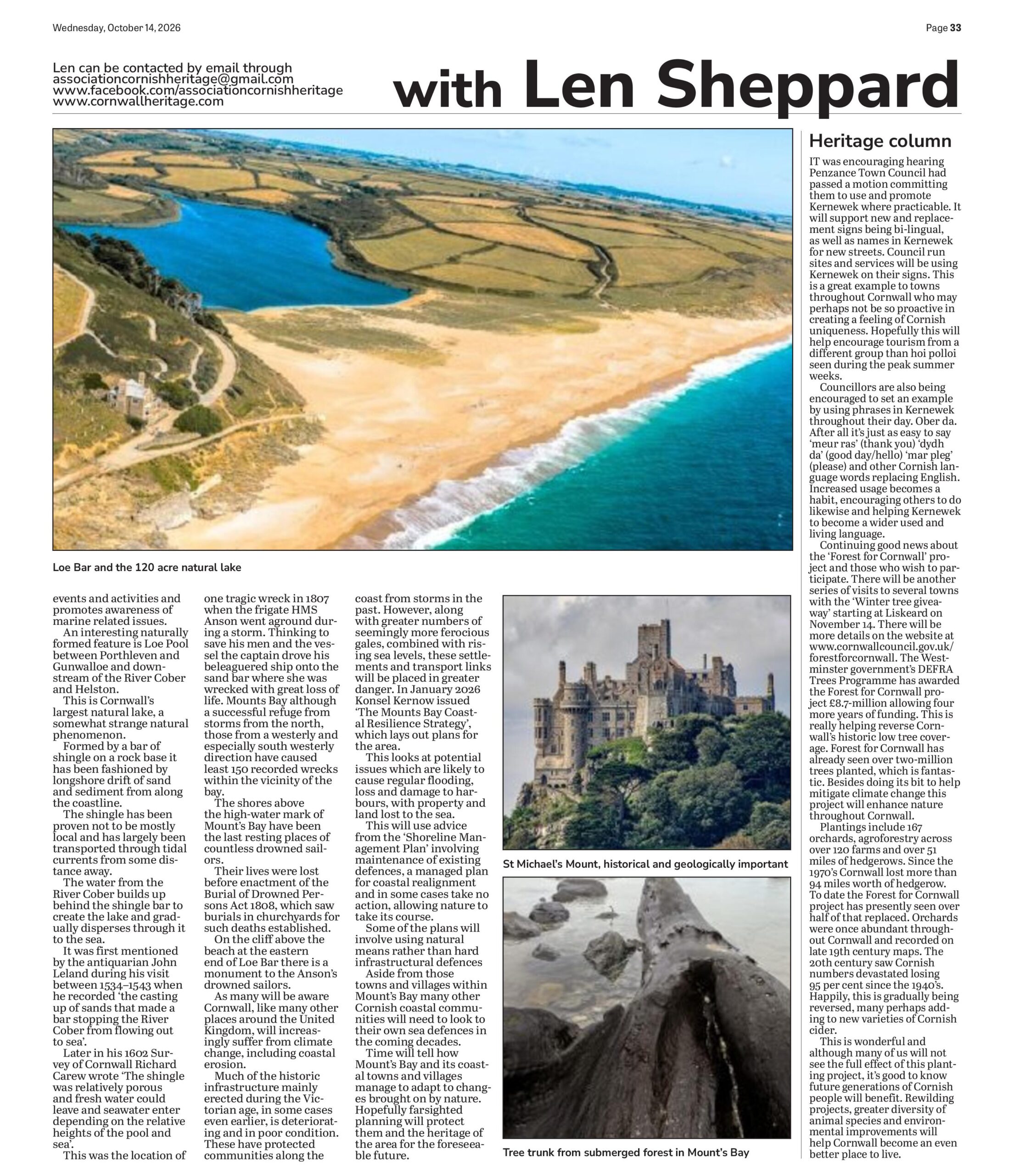
St Michael’s Mount is a jewel in Cornwall’s crown of its many historical buildings. Perhaps the significance of its location is often lost as Mount's Bay in which it stands is so large. Although named Mount’s Bay, it does not appear to the casual visitor to be a bay at all. The distance between the two points from Gwennap Head, near Porthgwarra Beach, to Lizard Head is some 21-miles with an internal coastline double that at around 42-miles. Along that coastline is one of Cornwall’s largest towns, Penzance, historic Marazion formerly Market Jew, together with longstanding fishing villages Newlyn, Mousehole and Porthleven. One of Cornwall’s most well-known smugglers, John Carter, had his base at Prussia Cove within Mount’s Bay. This article covers some of the natural aspects of this, the largest bay along Cornwall’s coastline. It and the communities which lie within it have a rich in history, some of which will be shared in another forthcoming article.
As always click the images for larger view
Mount’s Bay named after the historic St Michael’s Mount, which is also known in Kernewek as ‘Karrek Loos yn Koos’, meaning grey rock in the woodland. The submerged forest which lies beneath the sands within the bay and surrounding the mount was once woodland many thousands of years ago. The remains of trees fossilised and preserved are often seen at very low tides and after storms which disturb the sands. These trees would have once covered a large plain until rising sea levels finally overcame them. This lost area of land was occupied as far back as the Mesolithic Stone Age with many artefacts discovered confirming this. Occupation may have lasted until into the early Bronze Age when the forest was finally lost to the sea.
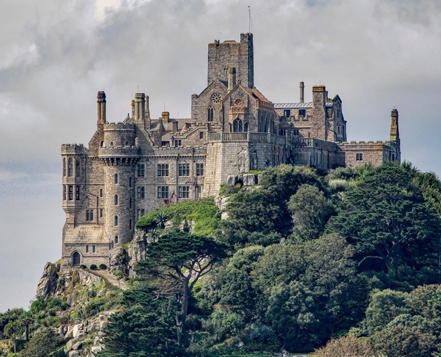
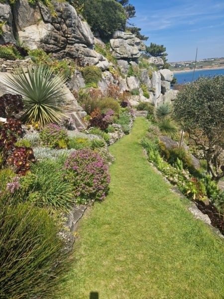
Access to the mount at low tide is via a causeway, St Michael’s Mount being one of the United Kingdom’s 43 unbridged tidal islands accessible by foot from the mainland. At high tide access is via a boat as sea height can vary by up to around 16-feet between low and high tide. Apart from its historic significance part of the island received designation as a Site of Special Scientific Interest in 1995 for its geology. Cornwall’s geology is complex and is not as many people imagine mostly granite. Cornwall’s base is largely granite and known as the ‘Cornubian Batholith’ but this is located at an estimated depth of about seven miles beneath the surface, with four major granite plutons rising to the surface. The ‘Cornubian Batholith’ lies beneath what is known as the ‘Cornubian Massif’ a sedimentary rock formation, which also covers much of Cornwall. What makes the mount so special is that it has igneous granite lying alongside metamorphosed fine-grained sedimentary rocks together with other mineralisation. This has created an opportunity to see the geology of Cornwall featured in a single location.
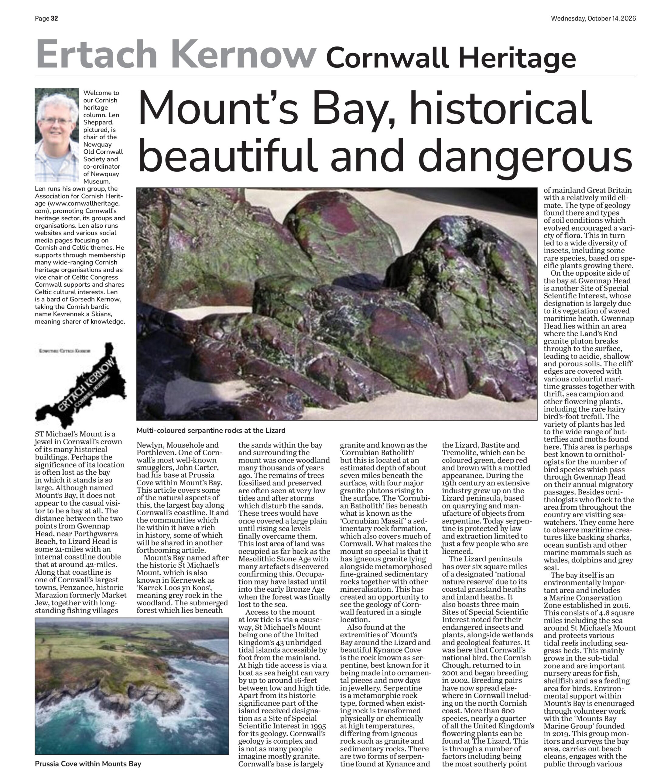
Also found at the extremities of Mount’s Bay around the Lizard and beautiful Kynance Cove is the rock known as serpentine, best known for it being made into ornamental pieces and now days in jewellery. Serpentine is a metamorphic rock type, formed when existing rock is transformed physically or chemically at high temperatures, differing from igneous rock such as granite and sedimentary rocks. There are two forms of serpentine found at Kynance and the Lizard, Bastite and Tremolite, which can be coloured green, deep red and brown with a mottled appearance. During the 19th century an extensive industry grew up on the Lizard peninsula, based on quarrying and manufacture of objects from serpentine. Today serpentine is protected by law and extraction limited to just a few people who are licenced.
The Lizard peninsula has over six square miles of a designated ‘national nature reserve’ due to its coastal grassland heaths and inland heaths. It also boasts three main Sites of Special Scientific Interest noted for their endangered insects and plants, alongside wetlands and geological features. It was here that Cornwall’s national bird, the Cornish Chough, returned to in 2001 and began breeding in 2002. Breeding pairs have now spread elsewhere in Cornwall including on the north Cornish coast. More than 600 species, nearly a quarter of all the United Kingdom’s flowering plants can be found at The Lizard. This is through a number of factors including being the most southerly point of mainland Great Britain with a relatively mild climate. The type of geology found there and types of soil conditions which evolved encouraged a variety of flora. This in turn led to a wide diversity of insects, including some rare species, based on specific plants growing there.


On the opposite side of the bay at Gwennap Head is another Site of Special Scientific Interest, whose designation is largely due to its vegetation of waved maritime heath. Gwennap Head lies within an area where the Land’s End granite pluton breaks through to the surface, leading to acidic, shallow and porous soils. The cliff edges are covered with various colourful maritime grasses together with thrift, sea campion and other flowering plants, including the rare hairy bird's-foot trefoil. The variety of plants has led to the wide range of butterflies and moths found here. This area is perhaps best known to ornithologists for the number of bird species which pass through Gwennap Head on their annual migratory passages. Besides ornithologists who flock to the area from throughout the country are visiting seawatchers. They come here to observe maritime creatures like basking sharks, ocean sunfish and other marine mammals such as whales, dolphins and grey seal.
The bay itself is an environmentally important area and includes a Marine Conservation Zone established in 2016. This consists of 4.6 square miles including the sea around St Michael's Mount and protects various tidal reefs including seagrass beds. This mainly grows in the sub-tidal zone and are important nursery areas for fish, shellfish and as a feeding area for birds. Environmental support within Mount’s Bay is encouraged through volunteer work with the ‘Mounts Bay Marine Group’ founded in 2019. This group monitors and surveys the bay area, carries out beach cleans, engages with the public through various events and activities and promotes awareness of marine related issues.

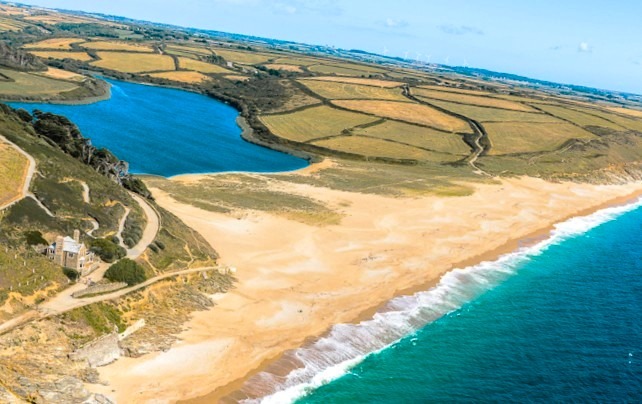

An interesting naturally formed feature is Loe Pool between Porthleven and Gunwalloe and downstream of the River Cober and Helston. This is Cornwall’s largest natural lake, a somewhat strange natural phenomenon. Formed by a bar of shingle on a rock base it has been fashioned by longshore drift of sand and sediment from along the coastline. The shingle has been proven not to be mostly local and has largely been transported through tidal currents from some distance away. The water from the River Cober builds up behind the shingle bar to create the lake and gradually disperses through it to the sea. It was first mentioned by the antiquarian John Leland during his visit between 1534–1543 when he recorded ‘the casting up of sands that made a bar stopping the River Cober from flowing out to sea’. Later in his 1602 Survey of Cornwall Richard Carew wrote ‘The shingle was relatively porous and fresh water could leave and seawater enter depending on the relative heights of the pool and sea’. This was the location of one tragic wreck in 1807 when the frigate HMS Anson went aground during a storm. Thinking to save his men and the vessel the captain drove his beleaguered ship onto the sand bar where she was wrecked with great loss of life. Mounts Bay although a successful refuge from storms from the north, those from a westerly and especially south westerly direction have caused least 150 recorded wrecks within the vicinity of the bay. The shores above the high-water mark of Mount’s Bay have been the last resting places of countless drowned sailors. Their lives were lost before enactment of the Burial of Drowned Persons Act 1808, which saw burials in churchyards for such deaths established. On the cliff above the beach at the eastern end of Loe Bar there is a monument to the Anson’s drowned sailors.
As many will be aware Cornwall, like many other places around the United Kingdom, will increasingly suffer from climate change, including coastal erosion. Much of the historic infrastructure mainly erected during the Victorian age, in some cases even earlier, is deteriorating and in poor condition. These have protected communities along the coast from storms in the past. However, along with greater numbers of seemingly more ferocious gales, combined with rising sea levels, these settlements and transport links will be placed in greater danger. In January 2026 Konsel Kernow issued ‘The Mounts Bay Coastal Resilience Strategy’, which lays out plans for the area. This looks at potential issues which are likely to cause regular flooding, loss and damage to harbours, with property and land lost to the sea. This will use advice from the ‘Shoreline Management Plan’ involving maintenance of existing defences, a managed plan for coastal realignment and in some cases take no action, allowing nature to take its course. Some of the plans will involve using natural means rather than hard infrastructural defences

Aside from those towns and villages within Mount’s Bay many other Cornish coastal communities will need to look to their own sea defences in the coming decades. Time will tell how Mount’s Bay and its coastal towns and villages manage to adapt to changes brought on by nature. Hopefully farsighted planning will protect them and the heritage of the area for the foreseeable future.
Heritage Column