Ertach Kernow - Cornish Rivers and their historical links to mining
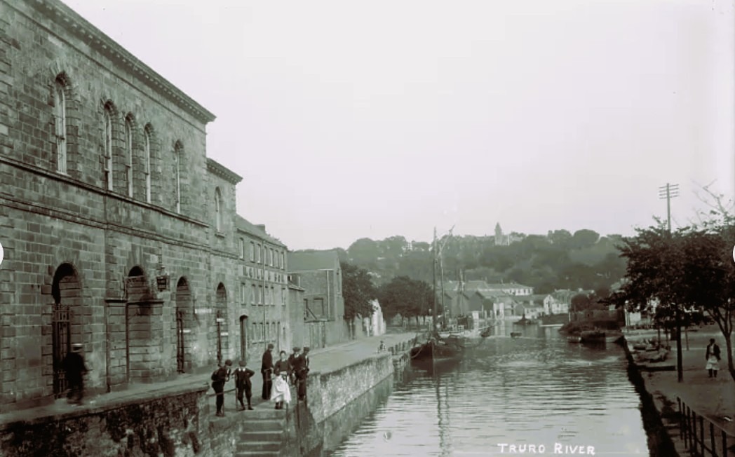
Cornwall’s rivers are much changed from the pre-industrialisation of Cornish tin and copper mining. Many rivers once used to transport good inland during medieval times have become silted up. Water carrying sediment pumped from the mines gradually settled in the upper regions downwards towards the sea. It was interesting to read that a project to dredge the Truro River is underway to make improved access to various quays by removing silt and deepening the river.
As always click the images for larger view
There are some forty-two named rivers in Cornwall, including the River Tamer marking Cornwall’s border with England. A river map of Cornwall shows it criss crossed with multiple waterways. Some of these are well known, others less so, along with scores of streams and smaller rivers which have no official names on Ordnance Survey maps. Some of these were and a few still are large enough for commercial use by smaller sea going vessels.
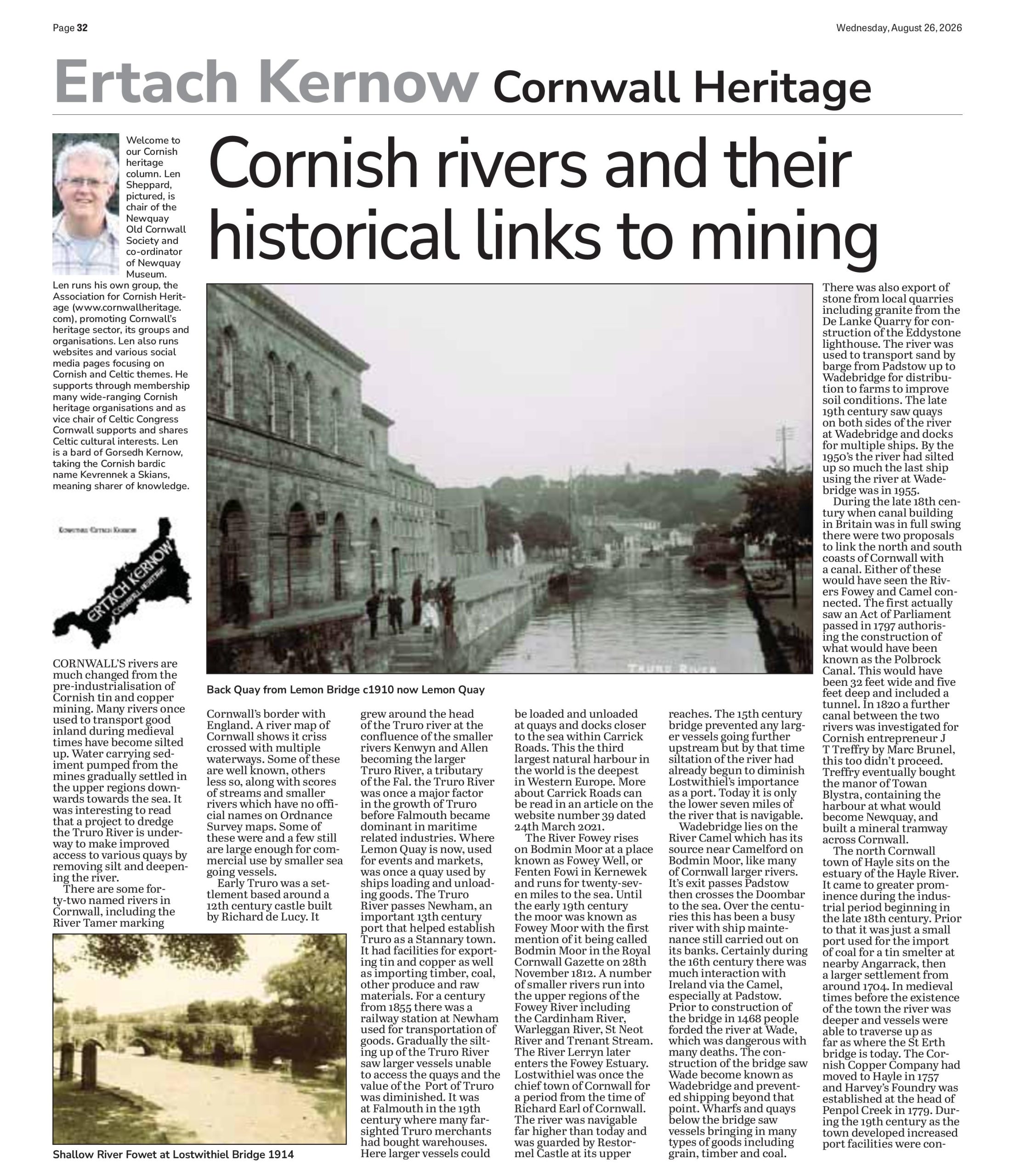
Early Truro was a settlement based around a 12th century castle built by Richard de Lucy. It grew around the head of the Truro river at the confluence of the smaller rivers Kenwyn and Allen becoming the larger Truro River, a tributary of the Fal. the Truro River was once a major factor in the growth of Truro before Falmouth became dominant in maritime related industries. Where Lemon Quay is now, used for events and markets, was once a quay used by ships loading and unloading goods. The Truro River passes Newham, an important 13th century port that helped establish Truro as a Stannary town. It had facilities for exporting tin and copper as well as importing timber, coal, other produce and raw materials. For a century from 1855 there was a railway station at Newham used for transportation of goods. Gradually the silting up of the Truro River saw larger vessels unable to access the quays and the value of the Port of Truro was diminished. It was at Falmouth in the 19th century where many farsighted Truro merchants had bought warehouses. Here larger vessels could be loaded and unloaded at quays and docks closer to the sea within Carrick Roads. This the third largest natural harbour in the world is the deepest in Western Europe. More about Carrick Roads can be read in an article on the website number 39 dated 24th March 2021.

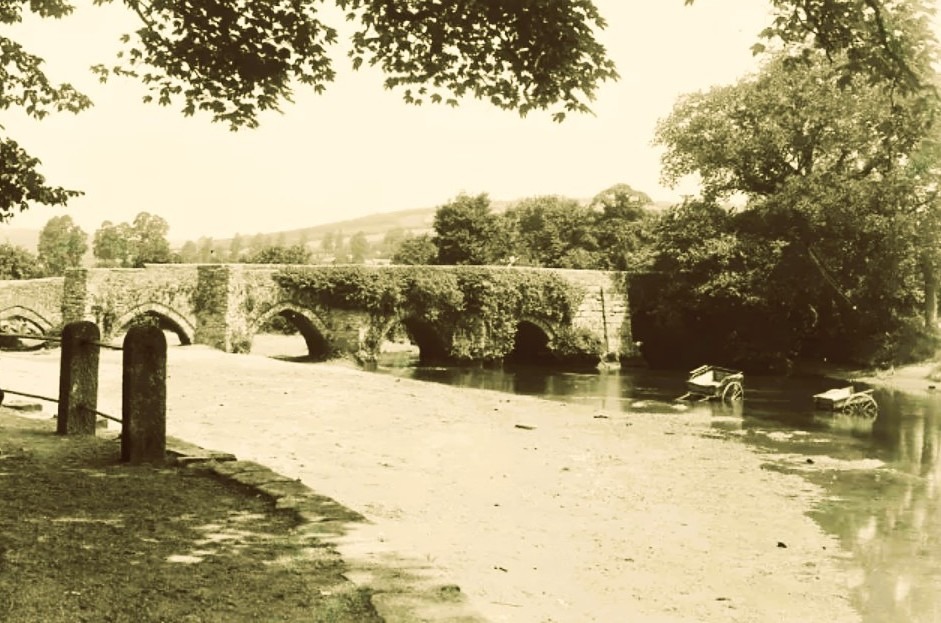
The River Fowey rises on Bodmin Moor at a place known as Fowey Well, or Fenten Fowi in Kernewek and runs for twenty-seven miles to the sea. Until the early 19th century the moor was known as Fowey Moor with the first mention of it being called Bodmin Moor in the Royal Cornwall Gazette on 28th November 1812. A number of smaller rivers run into the upper regions of the Fowey River including the Cardinham River, Warleggan River, St Neot River and Trenant Stream. The River Lerryn later enters the Fowey Estuary. Lostwithiel was once the chief town of Cornwall for a period from the time of Richard Earl of Cornwall. The river was navigable far higher than today and was guarded by Restormel Castle at its upper reaches. The 15th century bridge prevented any larger vessels going further upstream but by that time siltation of the river had already begun to diminish Lostwithiel’s importance as a port. Today it is only the lower seven miles of the river that is navigable.
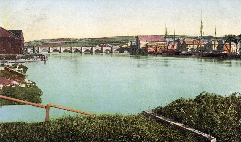
Wadebridge lies on the River Camel which has its source near Camelford on Bodmin Moor, like many of Cornwall larger rivers. It’s exit passes Padstow then crosses the Doombar to the sea. Over the centuries this has been a busy river with ship maintenance still carried out on its banks. Certainly during the 16th century there was much interaction with Ireland via the Camel, especially at Padstow. Prior to construction of the bridge in 1468 people forded the river at Wade, which was dangerous with many deaths. The construction of the bridge saw Wade become known as Wadebridge and prevented shipping beyond that point. Wharfs and quays below the bridge saw vessels bringing in many types of goods including grain, timber and coal. There was also export of stone from local quarries including granite from the De Lanke Quarry for construction of the Eddystone lighthouse. The river was used to transport sand by barge from Padstow up to Wadebridge for distribution to farms to improve soil conditions. The late 19th century saw quays on both sides of the river at Wadebridge and docks for multiple ships. By the 1950’s the river had silted up so much the last ship using the river at Wadebridge was in 1955.
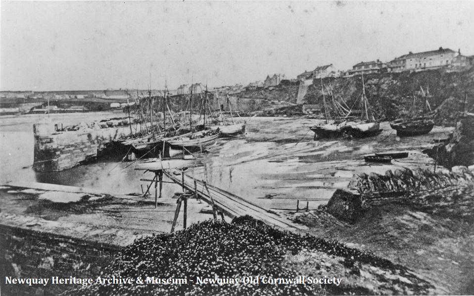
During the late 18th century when canal building in Britain was in full swing there were two proposals to link the north and south coasts of Cornwall with a canal. Either of these would have seen the Rivers Fowey and Camel connected. The first actually saw an Act of Parliament passed in 1797 authorising the construction of what would have been known as the Polbrock Canal. This would have been 32 feet wide and five feet deep and included a tunnel. In 1820 a further canal between the two rivers was investigated for Cornish entrepreneur J T Treffry by Marc Brunel, this too didn’t proceed. Treffry eventually bought the manor of Towan Blystra, containing the harbour at what would become Newquay, and built a mineral tramway across Cornwall.
The north Cornwall town of Hayle sits on the estuary of the Hayle River. It came to greater prominence during the industrial period beginning in the late 18th century. Prior to that it was just a small port used for the import of coal for a tin smelter at nearby Angarrack, then a larger settlement from around 1704. In medieval times before the existence of the town the river was deeper and vessels were able to traverse up as far as where the St Erth bridge is today. The Cornish Copper Company had moved to Hayle in 1757 and Harvey's Foundry was established at the head of Penpol Creek in 1779. During the 19th century as the town developed increased port facilities were constructed. Although the industry built at Hayle was not adversely affected by river silting it had become an issue in the shipping channels as a problem to be dealt with. So, within the new docks sluices were constructed to flush out the silt. This the most south-westerly estuary in the UK has seen the mudflats become home to a variety of wetland birds. Many thousand birds flock to the estuary during the winter months consisting of migrant and wintering waterfowl with wading birds, gulls, and terns during the summer.


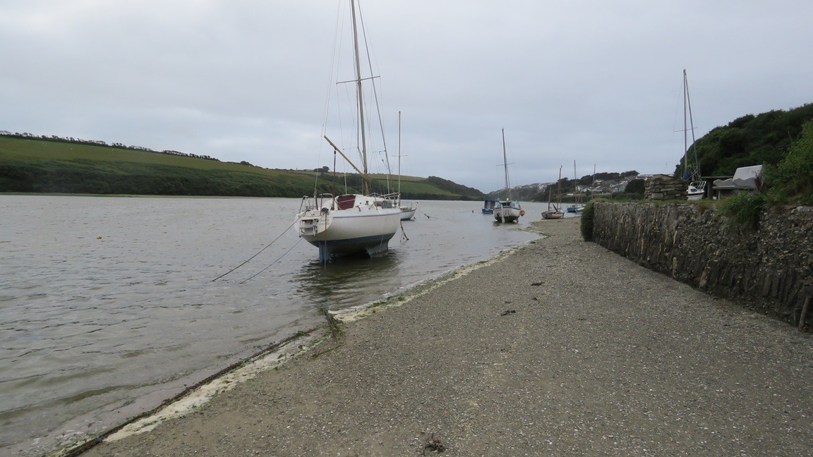
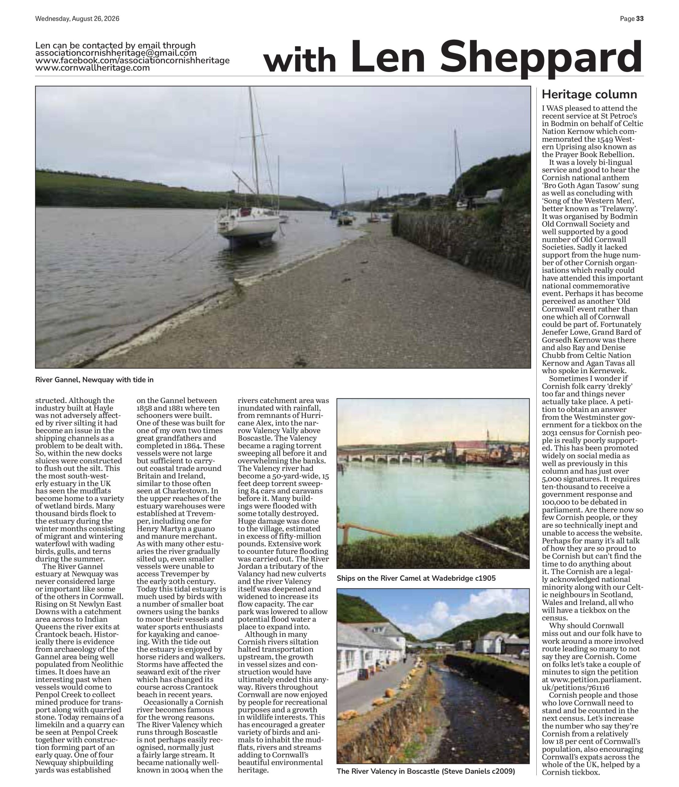
The River Gannel estuary at Newquay was never considered large or important like some of the others in Cornwall. Rising on St Newlyn East Downs with a catchment area across to Indian Queens the river exits at Crantock beach. Historically there is evidence from archaeology of the Gannel area being well populated from Neolithic times. It does have an interesting past when vessels would come to Penpol Creek to collect mined produce for transport along with quarried stone. Today remains of a limekiln and a quarry can be seen at Penpol Creek together with construction forming part of an early quay. One of four Newquay shipbuilding yards was established on the Gannel between 1858 and 1881 where ten schooners were built. One of these was built for one of my own two times great grandfathers and completed in 1864. These vessels were not large but sufficient to carryout coastal trade around Britain and Ireland, similar to those often seen at Charlestown. In the upper reaches of the estuary warehouses were established at Trevemper, including one for Henry Martyn a guano and manure merchant. As with many other estuaries the river gradually silted up, even smaller vessels were unable to access Trevemper by the early 20th century. Today this tidal estuary is much used by birds with a number of smaller boat owners using the banks to moor their vessels and water sports enthusiasts for kayaking and canoeing. With the tide out the estuary is enjoyed by horse riders and walkers. Storms have affected the seaward exit of the river which has changed its course across Crantock beach in recent years.
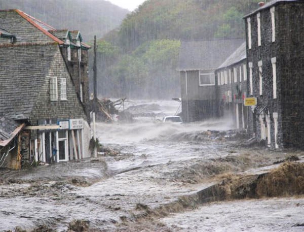
Occasionally a Cornish river becomes famous for the wrong reasons. The River Valency which runs through Boscastle is not perhaps easily recognised, normally just a fairly large stream. It became nationally well-known in 2004 when the rivers catchment area was inundated with rainfall, from remnants of Hurricane Alex, into the narrow Valency Valley above Boscastle. The Valency became a raging torrent sweeping all before it and overwhelming the banks. The Valency river had become a 50-yard-wide, 15 feet deep torrent sweeping 84 cars and caravans before it. Many buildings were flooded with some totally destroyed. Huge damage was done to the village, estimated in excess of fifty-million pounds. Extensive work to counter future flooding was carried out. The River Jordan a tributary of the Valancy had new culverts and the river Valency itself was deepened and widened to increase its flow capacity. The car park was lowered to allow potential flood water a place to expand into.
Although in many Cornish rivers siltation halted transportation upstream, the growth in vessel sizes and construction would have ultimately ended this anyway. Rivers throughout Cornwall are now enjoyed by people for recreational purposes and a growth in wildlife interests. This has encouraged a greater variety of birds and animals to inhabit the mudflats, rivers and streams adding to Cornwall’s beautiful environmental heritage.
Heritage Column