Ertach Kernow - Some historic aspects of Holywell and Cubert
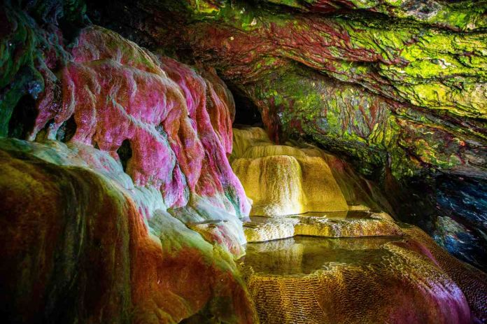
Cornish holy wells have been a source of interest for a very long time. It was so sad to hear that a rockfall on Holywell Beach has totally destroyed what was a cave with natural beautifully coloured rock formations. St Cuthberts Well as it was often called is said to have been a place where children were taken to cure rickets. Formed by water leaking through the rocks above the minerals formed the colourful cave and must have seen magical to people in earlier times. Although a great loss to Cornish heritage the cave and its rock formations have fortunately been recorded in countless photographs and text for over two-hundred years. This ensures that even if the tides of time and action of the seas do not once again expose this earthly phenomenon that future generations will still be able to marvel at this natural wonder.
As always click the images for larger view
Sharing this news does provide an opportunity to look at other ancient and historic features in this area of the north Cornish coast. There is another holy well close by at Trevornick as well as remains on the Kelsey’s of the cliff castle on Kelsey Head and a number of barrows along with others on nearby Cubert Common. Kelsey Head, the area above the now hidden St Cuthberts Cave, is a site of ancient occupation. The earliest evidence of this is the discovery of Mesolithic flints from the middle Stone Age at Penhale Head and the Kelsey’s. Although not too far from the coast now the early Mesolithic period would have seen the ocean far away from Cornwall’s current coastline. It was during this period that sea levels had risen significantly and much of any evidence of Mesolithic life would now be submerged.
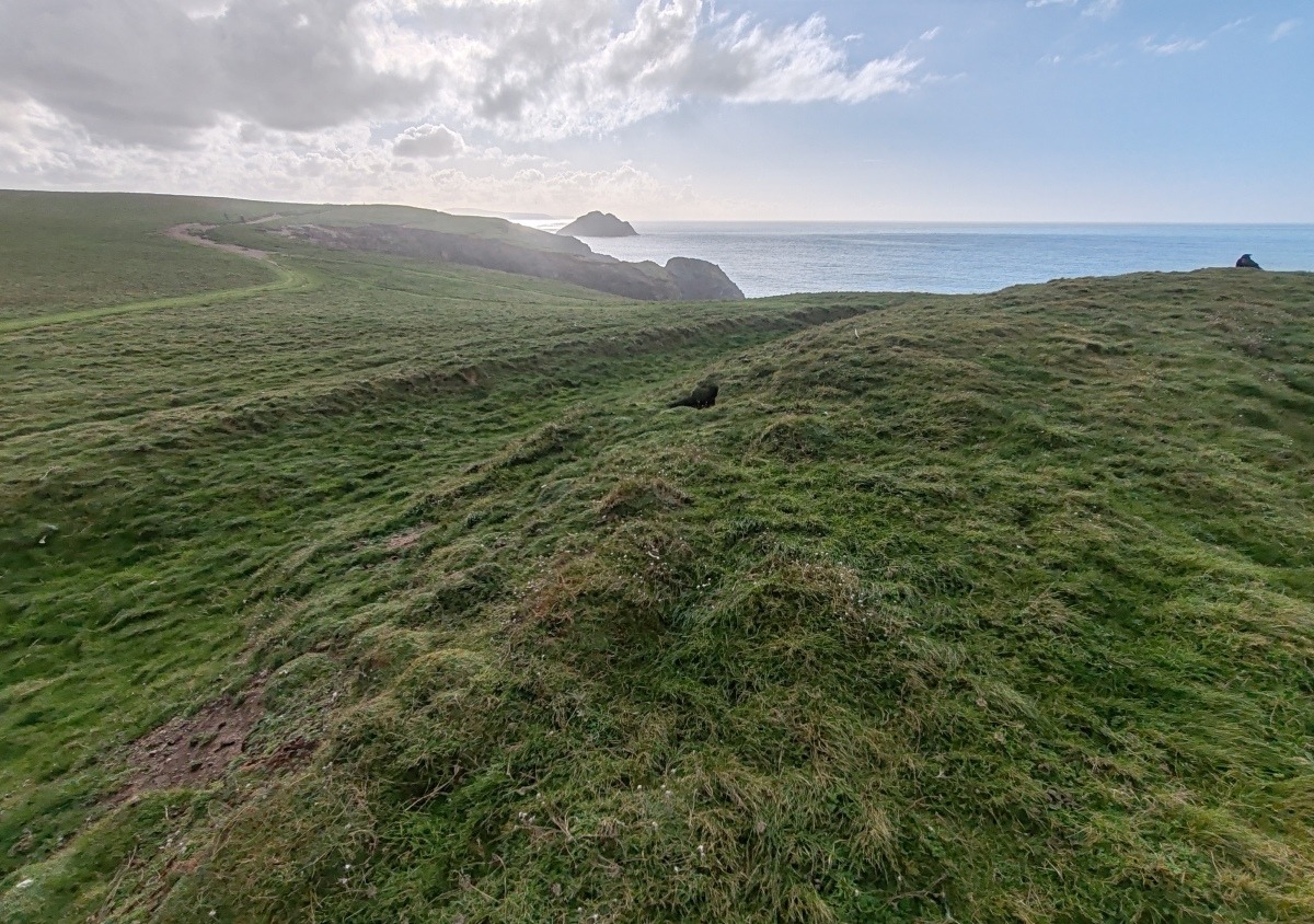
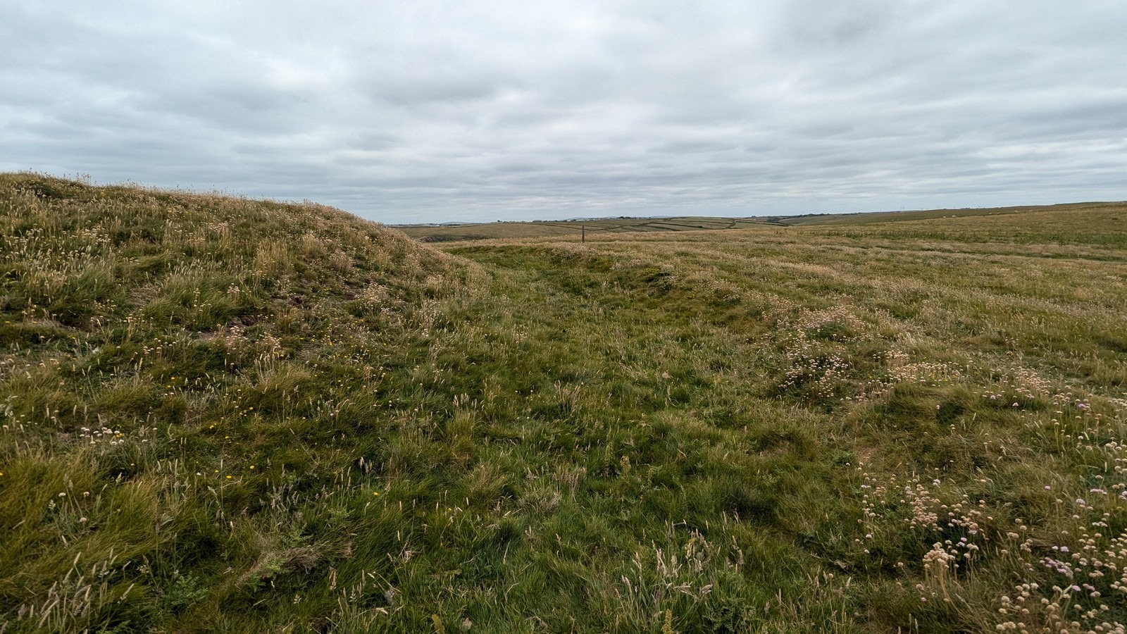
There is some evidence of Neolithic peoples in the immediate area, who would have taken advantage of the benefits of coastal living for food. However, it is from the succeeding Bronze Age that we find cairns and barrows located on Cubert Common and Penhale Sands providing continuing proof of nearby occupation dating back to some 4,000 years ago. The earliest Ordnance Survey map of the area published in 1813 clearly shows the Kelsey’s split into three sections by walls, although the cliff castle is not shown. The 1888 map does show the cliff castle on Kelsey Head and also marks the holy well on the beach below the Kelseys. This ancient Iron Age cliff castle would have likely enclosed an area far greater than today. Erosion would have taken its toll and like many cliff castles part of it fallen into the sea. There are no gaps forming an entrance which supports the theory of a loss of some of the ramparts and the entry way through sea erosion. This cliff castle is a far simpler structure than the fortifications at Trevelgue Head a little further up the coast beyond Newquay. The Kelsey Head cliff castle fortifications consists of a single L-shaped rampart of earth and stone incorporating natural rock outcrops with an external ditch. Within the rampart is evidence of at least four huts and adjacent to the main rampart is what is referred to as an annex with a wall and ditch. A LIDAR view of the site clearly shows the outlines of the rampart and ditch of the main enclosure. There are Bronze Age barrows on the Kelseys and Cubert Common which have had limited investigation. Sadly there has been damage to these from the 19th century onwards when farmers used barrows as a source of earth and stone. More recently they have been used by youths on trail bikes and motorcycles causing damage and erosion.
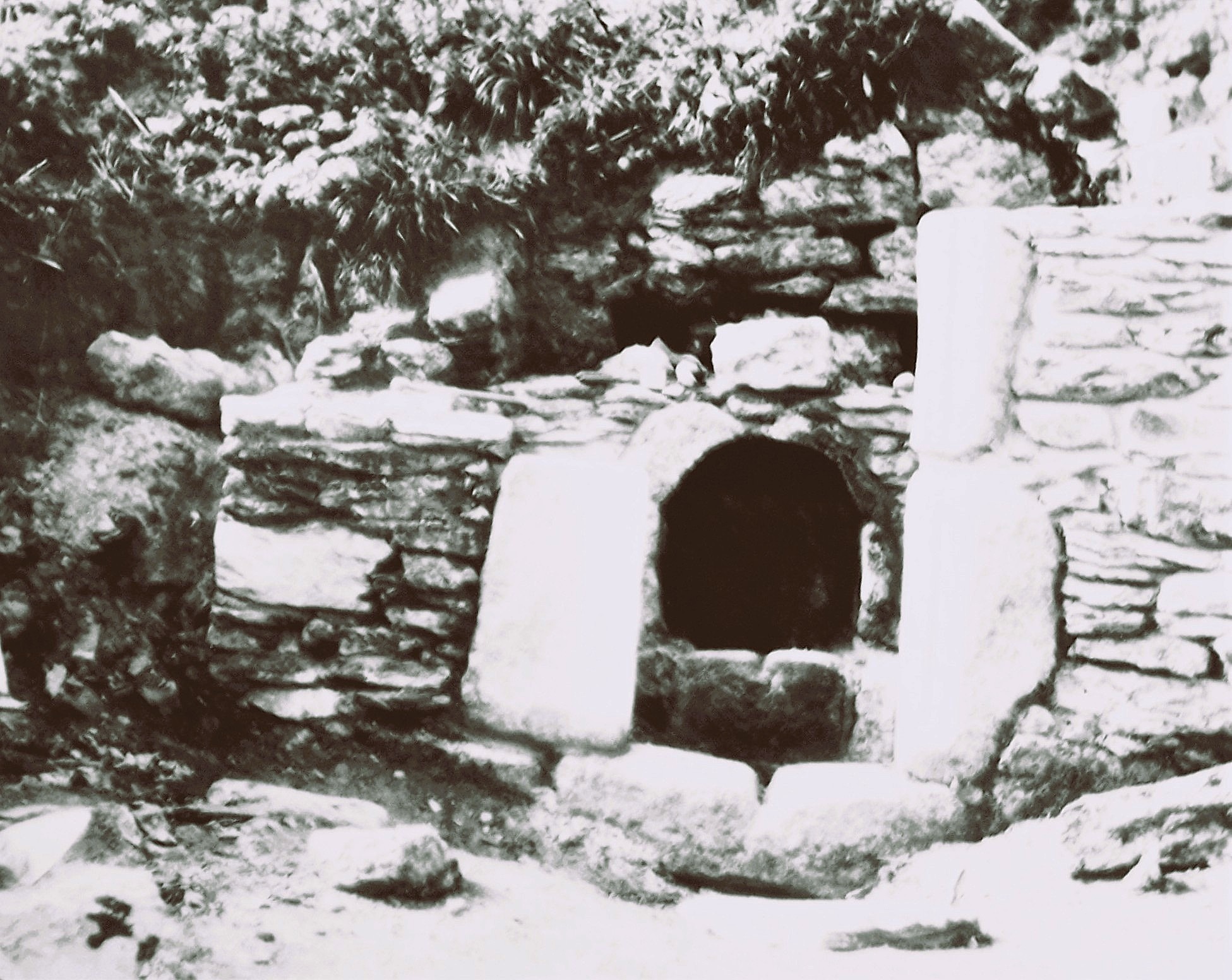
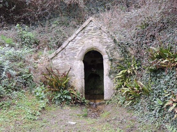
The holy well at Trevornick is less well-known than the cave on Holywell Beach. This is a Grade II listed building measuring just over seven-feet by nearly six-feet with a barrel vault roof and two stone seats on each longer side. South of the well-house is a twenty-two foot long stone wall with an arched entrance. Built over the holy well this 15th century structure gradually fell into disrepair. In 1936 the Newquay Old Cornwall Society undertook the rebuilding of the well-house as can be seen today. Over the past ninety years the society has continued its care for the well-house with the Newquay Old Cornwall Archaeology Group visiting and scrub-bashing invasive plants to ensure the well-being of this site. The ground approaching the holy well can become somewhat waterlogged and it is often difficult to access the building.
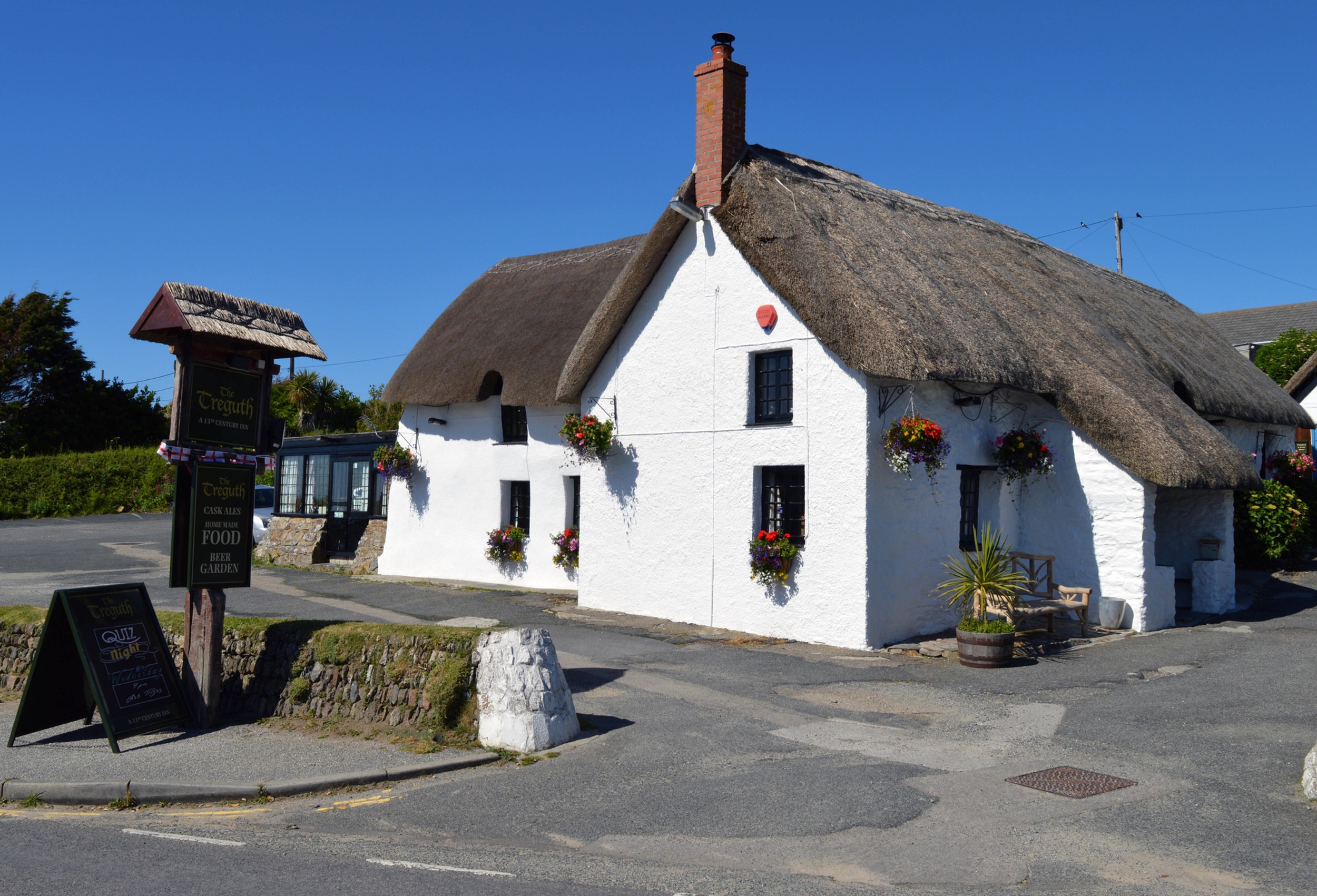
A further look at the 1888 Ordnance Survey map shows little settlement at Holywell excepting a farmhouse now the Treguth Inn. This is a Grade II listed thatched building dating back to the 17th century with later additions through to the 20th century. What is now Holywell was mentioned in earlier centuries, firstly in 1335 as Tregyeu. Today the name for Holywell in Kernewek is Tregew with the elements making its name farmstead or settlement and ‘hollow close’. The map also shows evidence of mine shafts relating to mining in the area around Holywell and Penhale Sands first recorded in 1777 through to the 19th century. Wheal Golden, Wheal Phoenix and Wheal Penhale were lead and silver mines, the engine houses ruins were destroyed during World War II during a raid on the nearby Penhale army training camp. Wheal Golden had its own smelting works. It’s a shame the Wheal Golden engine house no longer exists as it is said to have had ‘a fine castellated chimney stack’ in a style similar to that at Wheal Ellen which survives at Porthtowan further down the coast. Both the Phoenix, Penhale and Golden mines had multiple shafts reaching down up to six-hundred feet with adits still to be seen opening up on the cliff face. By 1874 all the mines had been closed for the final time.
The village of Cubert is surrounded by a number of smaller hamlets, which includes Tresean, Trevail and Ellenglaze. Although Cubert, or Egloskubert in Kernewek, was not mentioned in Domesday it was recorded as Sanctus Cubertus in 1269. Domesday did mention Ellenglaze as Elil in 1086 the additional glaze from Kernewek glas meaning blue/green was added later. Perhaps this was referring to the nearby creek. This manor was owned by the canons at Bodmin and valued at one pound and had a population of around eighty people in twenty households. Today this small hamlet includes the Grade II ‘manor house’ dating from the mid-17th century with later additions and alterations. The other hamlets of Tresean and Trevail contain a number of historic houses with thatched roofs.
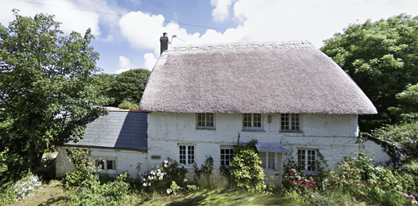
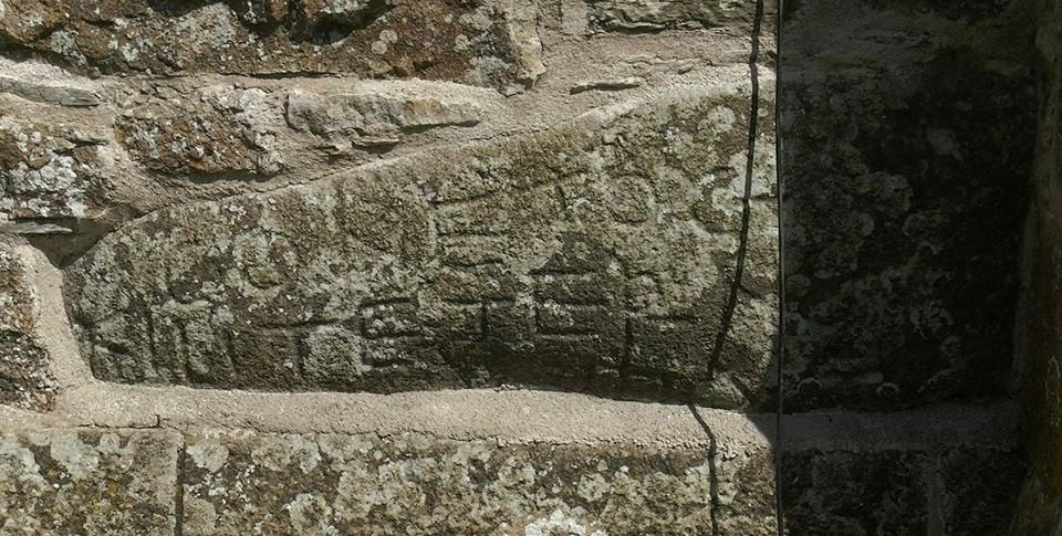
The churchtown of Cubert surrounds the church and the village has grown considerably in the past few decades. The Grade I listed church of St Cubert is of 13th century construction with 15th century additions and was restored in the 19th century. Its tower is rather unusual having a broach spire, this is an architecture feature of an octagonal spire rising directly from a square tower. Triangular sections of masonry, called broaches, are added to the spire's faces bridging any gaps. The tower also has a 6th century inscribed stone set into the lower west face of the tower. This has been laid horizontally with the inscription reading ‘CONETOCI FILI TEGERNOMALI,’ translated to ‘Conetocus son of Tegernomalus.’ This stone illustrates that there was occupation in the area during the early medieval period. It’s also thought by some that some larger stones, seen above ground and laid as part of the church foundations may have been standing stones dating from an earlier age.
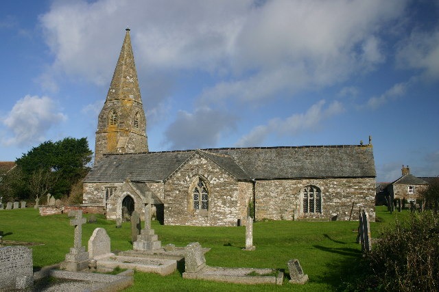
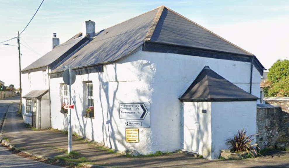
Besides the church with its quirky tower and steeple Cubert has another claim to religious fame. Cornwall became a bastion of early Methodism with John Wesley visiting and preaching many times. He visited Cubert a total of eleven times from 1751, describing the village as a ‘very special resting place’. One Joseph Hosken built what is thought to be the first purpose built Wesleyan chapel in Cornwall in 1765. It originally had a thatched roof, which has subsequently been replaced with slate. That this has survived is very fortunate seeing so many later chapels have been destroyed or left to fall to ruination. By 1907 it was being used as a Sunday school and is now a residential property. A new Methodist chapel was built around 1848 and an adjacent Sunday school in 1894. Falling congregation numbers led to the closure of the new chapel in 2011 and a year later the Sunday school was converted to a new small multipurpose chapel. The 1848 chapel has, like the first Methodist chapel and others throughout Cornwall, been converted into a residential property.
The sands at Holywell will have been seen by millions of people when they were used to film various scenes in the latest Poldark series. Although St Cuthbert’s cave is no longer accessible people should not stop visiting this beautiful part of Cornwall’s coastline. Much of the land here is owned by the National Trust with the Kelseys including the cliff castle on Kelsey head and Cubert Common offering enjoyable walks and lovely views. There is interesting wildlife and birds including seals on Chick Rock. Porth Joke, locally known as Polly Joke is a small beach on the northern side of the Kelseys and the adjacent National Trust land offers wonderful views of the bright red poppy fields in early summer.
Heritage Column
Heritage in the News online links: